Kepoh geodata
Kepoh (Bangka–Belitung Islands) is a seat of a third-order administrative division; located in Indonesia in Asia/Jakarta (GMT+7) time zone. In our database, there are 407 cities with bigger population. Compared to other cities in Indonesia, 91.4% of cities are located further ↓South; 87.3% of cities are located further →East and 90.6% of cities have higher elevation than Kepoh. Note1


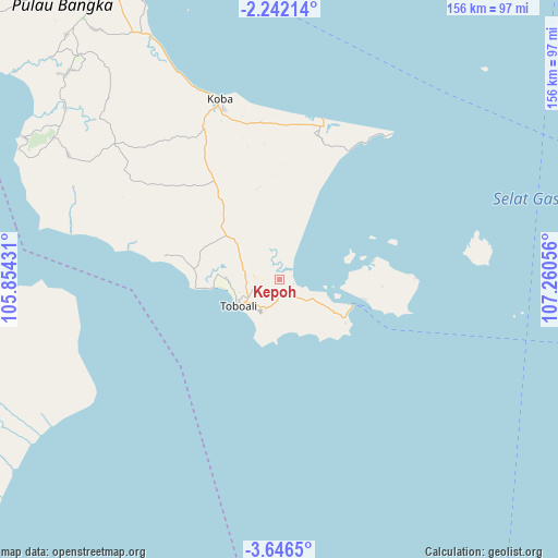
Kepoh GPS coordinates[2]
2° 56' 40.344" South, 106° 33' 26.748" East
| Map corner | latitude | longitude |
|---|---|---|
| Upper-left | -2.24214°, | 105.85431° |
| Center: | -2.94454°, | 106.55743° |
| Lower-right: | -3.6465°, | 107.26056° |
| Map W x H: | 156.2×156.2 km | = 97.1×97.1mi |
| max Lat: | 5.88969° ⇑8.6% North |
| Kepoh: | -2.94454° |
| min Lat: | ⇓91.4% South -10.934° |
| min Long | Kepoh | max Long |
| 95.1345° | 106.55743° | 140.9419° |
| W 12.7%⇐ | ⇒87.3% E |
Elevation
Elevation of Kepoh is 10 m = 33 ft, and this is 219.7 m = 721 ft below average elevation for this country.
| Max E: |
3185 m = 10449 ft | 90.6% |
| Avg. | 229.7 m = 754 ft | |
| Kepoh | 10 m = 33 ft | |
Min E: |
-1 m = -3 ft | 9.4% |
See also: Indonesia elevation on elevation.city.
Geographical zone
Kepoh is located in South Torrid zone (between Equator and Tropic of Capricorn). Distance of Equator is 327.4 km =203.4 mi to North.| Distance of | km | miles | from Kepoh |
|---|---|---|---|
| Equator | 327.4 | 203.4 | to North |
| Tropic Capricorn | 2278.5 | 1415.8 | to South |
| Antarctic Circle | 7073.8 | 4395.5 | to South |
| South Pole | 9679.7 | 6014.7 | to South |


Nearby cities:
15 places around Kepoh: (largest is in red/bold)
• Jebus
181.2 km =112.6 mi,  317°
317°
• Kayu Agung
198.1 km =123.1 mi,  255°
255°
• Kelapa
153.8 km =95.6 mi, 320°
• Koba
52.9 km =32.9 mi,  341°
341°
• Manggar
189.9 km =118 mi,  87°
87°
• Mislak
182.6 km =113.5 mi, 317°
• Muntok
183.1 km =113.8 mi,  302°
302°
• Pangkalpinang
103.2 km =64.1 mi,  331°
331°
• Sungaigerong
189.8 km =117.9 mi,  268°
268°
• Sungailiat
130.5 km =81.1 mi, 338°
• Sungsang
194.7 km =121 mi,  289°
289°
• Tanjung Lubuk
195.9 km =121.7 mi, 256°
• Tanjung Pandan
121.9 km =75.7 mi,  78°
78°
• Teritip
180.7 km =112.3 mi,  313°
313°
• Wiralaga Mulya
154.6 km =96.1 mi,  229°
229°
Sources, notices
• [Note1] Compared only with cities in Indonesia existing in our database
• [Src1] Map data: © OpenStreetMap contributors (CC-BY-SA)
• [Src2] Other city data from geonames.org with taken over terms of usage.
• [Src3] Geographical zone / Annual Mean Temperature by Robert A. Rohde @ Wikipedia
