Pangkalpinang geodata
Pangkalpinang (Bangka–Belitung Islands) is a seat of a first-order administrative division; located in Indonesia in Asia/Jakarta (GMT+7) time zone. With population of 125,933 people, there are 101 cities with bigger population in this country. Compared to other cities in Indonesia, 92.7% of cities are located further ↓South; 89.3% of cities are located further →East and 90.6% of cities have higher elevation than Pangkalpinang. Note1


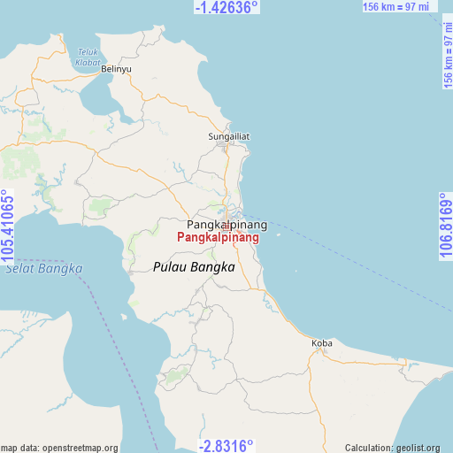
Pangkalpinang GPS coordinates[2]
2° 7' 44.904" South, 106° 6' 49.572" East
| Map corner | latitude | longitude |
|---|---|---|
| Upper-left | -1.42636°, | 105.41065° |
| Center: | -2.12914°, | 106.11377° |
| Lower-right: | -2.8316°, | 106.8169° |
| Map W x H: | 156.2×156.3 km | = 97.1×97.1mi |
| max Lat: | 5.88969° ⇑7.3% North |
| Pangkalpinang: | -2.12914° |
| min Lat: | ⇓92.7% South -10.934° |
| min Long | Pangkalpinang | max Long |
| 95.1345° | 106.11377° | 140.9419° |
| W 10.7%⇐ | ⇒89.3% E |
Elevation
Elevation of Pangkalpinang is 10 m = 33 ft, and this is 219.7 m = 721 ft below average elevation for this country.
| Max E: |
3185 m = 10449 ft | 90.6% |
| Avg. | 229.7 m = 754 ft | |
| Pangkalpinang | 10 m = 33 ft | |
Min E: |
-1 m = -3 ft | 9.4% |
See also: Pangkalpinang elevation on elevation.city.
Geographical zone
Pangkalpinang is located in South Torrid zone (between Equator and Tropic of Capricorn). Distance of Equator is 236.7 km =147.1 mi to North.| Distance of | km | miles | from Pangkalpinang |
|---|---|---|---|
| Equator | 236.7 | 147.1 | to North |
| Tropic Capricorn | 2369.2 | 1472.2 | to South |
| Antarctic Circle | 7164.4 | 4451.8 | to South |
| South Pole | 9770.3 | 6071 | to South |


Nearby cities:
15 places around Pangkalpinang: (largest is in red/bold)
• Jebus
84.8 km =52.7 mi,  300°
300°
• Kayu Agung
200.1 km =124.3 mi,  225°
225°
• Kelapa
56.1 km =34.9 mi, 299°
• Kepoh
103.2 km =64.1 mi,  151°
151°
• Koba
52 km =32.3 mi,  141°
141°
• Mislak
85.9 km =53.4 mi, 301°
• Muntok
105.9 km =65.8 mi,  273°
273°
• Palembang
175.4 km =109 mi,  240°
240°
• Sungaigerong
169.5 km =105.3 mi, 236°
• Sungailiat
30.6 km =19 mi,  1°
1°
• Sungsang
136.9 km =85.1 mi,  259°
259°
• Talangbetutu
178.5 km =110.9 mi, 242°
• Tanjung Lubuk
196.6 km =122.2 mi, 225°
• Tanjung Pandan
181.8 km =113 mi,  111°
111°
• Teritip
89 km =55.3 mi,  291°
291°
Sources, notices
• [Note1] Compared only with cities in Indonesia existing in our database
• [Src1] Map data: © OpenStreetMap contributors (CC-BY-SA)
• [Src2] Other city data from geonames.org with taken over terms of usage.
• [Src3] Geographical zone / Annual Mean Temperature by Robert A. Rohde @ Wikipedia
