Jepara geodata
Jepara (Central Java) is a seat of a second-order administrative division; located in Indonesia in Asia/Jakarta (GMT+7) time zone. In our database, there are 407 cities with bigger population. Compared to other cities in Indonesia, 82.8% of cities are located further ↓South; 65.3% of cities are located further →East and 98.5% of cities have higher elevation than Jepara. Note1


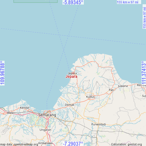
Jepara GPS coordinates[2]
6° 35' 32.64" South, 110° 40' 15.6" East
| Map corner | latitude | longitude |
|---|---|---|
| Upper-left | -5.89345°, | 109.96788° |
| Center: | -6.5924°, | 110.671° |
| Lower-right: | -7.29037°, | 111.37413° |
| Map W x H: | 155.3×155.3 km | = 96.5×96.5mi |
| max Lat: | 5.88969° ⇑17.2% North |
| Jepara: | -6.5924° |
| min Lat: | ⇓82.8% South -10.934° |
| min Long | Jepara | max Long |
| 95.1345° | 110.671° | 140.9419° |
| W 34.7%⇐ | ⇒65.3% E |
Elevation
Elevation of Jepara is 5 m = 16 ft, and this is 224.7 m = 737 ft below average elevation for this country.
| Max E: |
3185 m = 10449 ft | 98.5% |
| Avg. | 229.7 m = 754 ft | |
| Jepara | 5 m = 16 ft | |
Min E: |
-1 m = -3 ft | 1.5% |
See also: Indonesia elevation on elevation.city.
Geographical zone
Jepara is located in South Torrid zone (between Equator and Tropic of Capricorn). Distance of Equator is 733 km =455.5 mi to North.| Distance of | km | miles | from Jepara |
|---|---|---|---|
| Equator | 733 | 455.5 | to North |
| Tropic Capricorn | 1872.9 | 1163.8 | to South |
| Antarctic Circle | 6668.2 | 4143.4 | to South |
| South Pole | 9274.1 | 5762.7 | to South |


Nearby cities:
15 places around Jepara: (largest is in red/bold)
• Baekrajan
28.1 km =17.5 mi,  133°
133°
• Bancak Wetan
35 km =21.7 mi,  83°
83°
• Batang
12.7 km =7.9 mi,  18°
18°
• Cabak Satu
35.8 km =22.2 mi,  95°
95°
• Demak
33.4 km =20.8 mi,  185°
185°
• Gebog
24.9 km =15.5 mi, 129°
• Gunungwungkal
35.3 km =21.9 mi,  85°
85°
• Jekulo
36.8 km =22.9 mi, 130°
• Jembul Kulon
36.5 km =22.7 mi, 82°
• Krajan Gajihan
36.6 km =22.7 mi, 87°
• Kudus
30.1 km =18.7 mi,  141°
141°
• Lahar
36.1 km =22.4 mi, 99°
• Mlonggo
7.3 km =4.5 mi,  25°
25°
• Pecangaan
12.5 km =7.8 mi,  159°
159°
• Welahan
23.6 km =14.7 mi,  167°
167°
Sources, notices
• [Note1] Compared only with cities in Indonesia existing in our database
• [Src1] Map data: © OpenStreetMap contributors (CC-BY-SA)
• [Src2] Other city data from geonames.org with taken over terms of usage.
• [Src3] Geographical zone / Annual Mean Temperature by Robert A. Rohde @ Wikipedia
