Jeneponto geodata
Jeneponto (South Sulawesi) is a seat of a second-order administrative division; located in Indonesia in Asia/Makassar (GMT+8) time zone. In our database, there are 407 cities with bigger population. Compared to other cities in Indonesia, 88.1% of cities are located further ↓South; 82.2% of cities are located further ←West and 74.9% of cities have higher elevation than Jeneponto. Note1


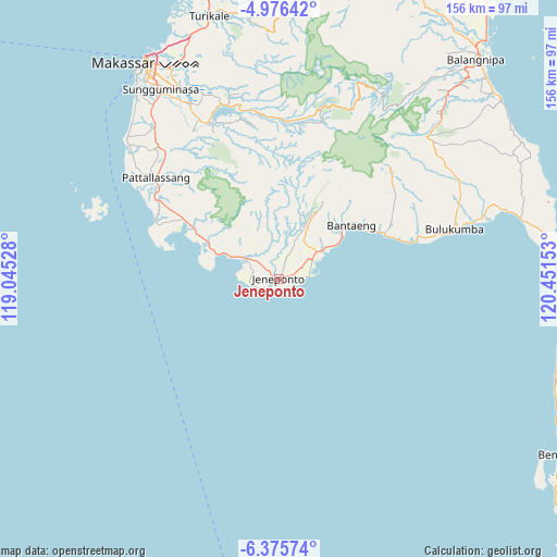
Jeneponto GPS coordinates[2]
5° 40' 35.4" South, 119° 44' 54.24" East
| Map corner | latitude | longitude |
|---|---|---|
| Upper-left | -4.97642°, | 119.04528° |
| Center: | -5.6765°, | 119.7484° |
| Lower-right: | -6.37574°, | 120.45153° |
| Map W x H: | 155.6×155.6 km | = 96.7×96.7mi |
| max Lat: | 5.88969° ⇑11.9% North |
| Jeneponto: | -5.6765° |
| min Lat: | ⇓88.1% South -10.934° |
| min Long | Jeneponto | max Long |
| 95.1345° | 119.7484° | 140.9419° |
| W 82.2%⇐ | ⇒17.8% E |
Elevation
Elevation of Jeneponto is 25 m = 82 ft, and this is 204.7 m = 672 ft below average elevation for this country.
| Max E: |
3185 m = 10449 ft | 74.9% |
| Avg. | 229.7 m = 754 ft | |
| Jeneponto | 25 m = 82 ft | |
Min E: |
-1 m = -3 ft | 25.1% |
See also: Indonesia elevation on elevation.city.
Geographical zone
Jeneponto is located in South Torrid zone (between Equator and Tropic of Capricorn). Distance of Equator is 631.2 km =392.2 mi to North.| Distance of | km | miles | from Jeneponto |
|---|---|---|---|
| Equator | 631.2 | 392.2 | to North |
| Tropic Capricorn | 1974.8 | 1227.1 | to South |
| Antarctic Circle | 6770 | 4206.7 | to South |
| South Pole | 9375.9 | 5825.9 | to South |


Nearby cities:
15 places around Jeneponto: (largest is in red/bold)
• Bantaeng
26.6 km =16.5 mi,  57°
57°
• Benteng
92.8 km =57.7 mi,  121°
121°
• Bulubulu
103.4 km =64.2 mi,  34°
34°
• Bulukumba
50.1 km =31.1 mi,  73°
73°
• Camming
102.8 km =63.9 mi,  20°
20°
• Galesong
58.2 km =36.2 mi,  313°
313°
• Kadai
116.8 km =72.6 mi, 34°
• Makassar
68.4 km =42.5 mi,  329°
329°
• Maros
77 km =47.8 mi,  345°
345°
• Matango
116.6 km =72.5 mi,  14°
14°
• Palattae
88.2 km =54.8 mi, 27°
• Pangkajene
95.9 km =59.6 mi, 346°
• Sinjai
83 km =51.6 mi,  42°
42°
• Sungguminasa
62.6 km =38.9 mi, 328°
• Takalar
44.2 km =27.5 mi, 309°
Sources, notices
• [Note1] Compared only with cities in Indonesia existing in our database
• [Src1] Map data: © OpenStreetMap contributors (CC-BY-SA)
• [Src2] Other city data from geonames.org with taken over terms of usage.
• [Src3] Geographical zone / Annual Mean Temperature by Robert A. Rohde @ Wikipedia
