Benteng geodata
Benteng (South Sulawesi) is a seat of a second-order administrative division; located in Indonesia in Asia/Makassar (GMT+8) time zone. In our database, there are 407 cities with bigger population. Compared to other cities in Indonesia, 87.9% of cities are located further ↓South; 84.1% of cities are located further ←West and 95.5% of cities have higher elevation than Benteng. Note1


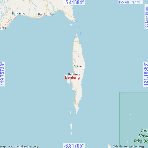
Benteng GPS coordinates[2]
6° 7' 6.24" South, 120° 27' 37.8" East
| Map corner | latitude | longitude |
|---|---|---|
| Upper-left | -5.41884°, | 119.75738° |
| Center: | -6.1184°, | 120.4605° |
| Lower-right: | -6.81705°, | 121.16363° |
| Map W x H: | 155.5×155.5 km | = 96.6×96.6mi |
| max Lat: | 5.88969° ⇑12.1% North |
| Benteng: | -6.1184° |
| min Lat: | ⇓87.9% South -10.934° |
| min Long | Benteng | max Long |
| 95.1345° | 120.4605° | 140.9419° |
| W 84.1%⇐ | ⇒15.9% E |
Elevation
Elevation of Benteng is 7 m = 23 ft, and this is 222.7 m = 731 ft below average elevation for this country.
| Max E: |
3185 m = 10449 ft | 95.5% |
| Avg. | 229.7 m = 754 ft | |
| Benteng | 7 m = 23 ft | |
Min E: |
-1 m = -3 ft | 4.5% |
See also: Indonesia elevation on elevation.city.
Geographical zone
Benteng is located in South Torrid zone (between Equator and Tropic of Capricorn). Distance of Equator is 680.3 km =422.7 mi to North.| Distance of | km | miles | from Benteng |
|---|---|---|---|
| Equator | 680.3 | 422.7 | to North |
| Tropic Capricorn | 1925.6 | 1196.5 | to South |
| Antarctic Circle | 6720.9 | 4176.2 | to South |
| South Pole | 9326.8 | 5795.4 | to South |


Nearby cities:
15 places around Benteng: (largest is in red/bold)
• Apala
168.2 km =104.5 mi,  354°
354°
• Bantaeng
84.9 km =52.8 mi,  318°
318°
• Bulubulu
135.5 km =84.2 mi, 351°
• Bulukumba
70.2 km =43.6 mi,  334°
334°
• Camming
151.4 km =94.1 mi,  343°
343°
• Galesong
150.4 km =93.5 mi,  306°
306°
• Jeneponto
92.8 km =57.7 mi,  301°
301°
• Kadai
146.3 km =90.9 mi, 354°
• Makassar
156.8 km =97.4 mi, 313°
• Maros
158 km =98.2 mi, 321°
• Matango
169.3 km =105.2 mi, 343°
• Palattae
133.2 km =82.8 mi, 343°
• Sinjai
112.9 km =70.2 mi, 348°
• Sungguminasa
151.6 km =94.2 mi, 312°
• Takalar
136.8 km =85 mi, 304°
Sources, notices
• [Note1] Compared only with cities in Indonesia existing in our database
• [Src1] Map data: © OpenStreetMap contributors (CC-BY-SA)
• [Src2] Other city data from geonames.org with taken over terms of usage.
• [Src3] Geographical zone / Annual Mean Temperature by Robert A. Rohde @ Wikipedia
