Gampengrejo geodata
Gampengrejo (East Java) is a populated place; located in Indonesia in Asia/Jakarta (GMT+7) time zone. With population of 49,118 people, there are 233 cities with bigger population in this country. Compared to other cities in Indonesia, 60.6% of cities are located further ↑North; 50.2% of cities are located further ←West and 60.1% of cities have higher elevation than Gampengrejo. Note1


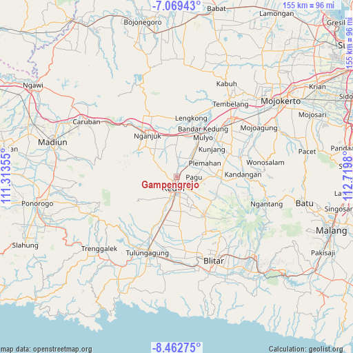
Gampengrejo GPS coordinates[2]
7° 46' 0.012" South, 112° 1' 0.012" East
| Map corner | latitude | longitude |
|---|---|---|
| Upper-left | -7.06943°, | 111.31355° |
| Center: | -7.76667°, | 112.01667° |
| Lower-right: | -8.46275°, | 112.7198° |
| Map W x H: | 154.9×154.9 km | = 96.3×96.3mi |
| max Lat: | 5.88969° ⇑60.6% North |
| Gampengrejo: | -7.76667° |
| min Lat: | ⇓39.4% South -10.934° |
| min Long | Gampengrejo | max Long |
| 95.1345° | 112.01667° | 140.9419° |
| W 50.2%⇐ | ⇒49.8% E |
Elevation
Elevation of Gampengrejo is 59 m = 194 ft, and this is 170.7 m = 560 ft below average elevation for this country.
| Max E: |
3185 m = 10449 ft | 60.1% |
| Avg. | 229.7 m = 754 ft | |
| Gampengrejo | 59 m = 194 ft | |
Min E: |
-1 m = -3 ft | 39.9% |
See also: Gampengrejo elevation on elevation.city.
Geographical zone
Gampengrejo is located in South Torrid zone (between Equator and Tropic of Capricorn). Distance of Equator is 863.6 km =536.6 mi to North.| Distance of | km | miles | from Gampengrejo |
|---|---|---|---|
| Equator | 863.6 | 536.6 | to North |
| Tropic Capricorn | 1742.3 | 1082.6 | to South |
| Antarctic Circle | 6537.6 | 4062.3 | to South |
| South Pole | 9143.5 | 5681.5 | to South |


Nearby cities:
15 places around Gampengrejo: (largest is in red/bold)
• Karangrejo
28.8 km =17.9 mi,  204°
204°
• Kediri
5.6 km =3.5 mi,  180°
180°
• Kertosono
22.4 km =13.9 mi,  24°
24°
• Ngamba
27.8 km =17.3 mi,  187°
187°
• Nganjuk
21.9 km =13.6 mi,  325°
325°
• Ngantru
28.9 km =18 mi, 200°
• Ngasem
5.1 km =3.2 mi,  148°
148°
• Ngasinan
28.8 km =17.9 mi, 198°
• Ngoro
28.1 km =17.5 mi,  70°
70°
• Pakel
28.8 km =17.9 mi, 204°
• Pare
20 km =12.4 mi,  90°
90°
• Pulerejo
27.6 km =17.1 mi, 197°
• Tambakrejo
27.8 km =17.3 mi, 192°
• Tebokan
28.9 km =18 mi, 203°
• Temenggungan
26.4 km =16.4 mi, 188°
Sources, notices
• [Note1] Compared only with cities in Indonesia existing in our database
• [Src1] Map data: © OpenStreetMap contributors (CC-BY-SA)
• [Src2] Other city data from geonames.org with taken over terms of usage.
• [Src3] Geographical zone / Annual Mean Temperature by Robert A. Rohde @ Wikipedia
