Buntok geodata
Buntok (Central Kalimantan) is a seat of a second-order administrative division; located in Indonesia in Asia/Pontianak (GMT+7) time zone. In our database, there are 407 cities with bigger population. Compared to other cities in Indonesia, 93.2% of cities are located further ↓South; 70.2% of cities are located further ←West and 84.2% of cities have higher elevation than Buntok. Note1


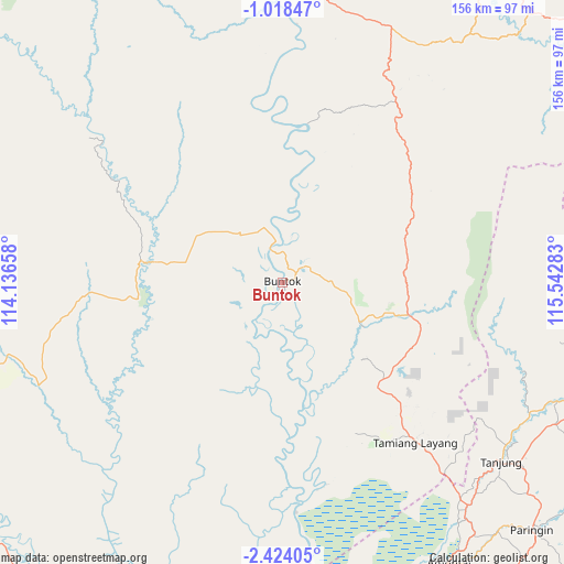
Buntok GPS coordinates[2]
1° 43' 17.004" South, 114° 50' 22.92" East
| Map corner | latitude | longitude |
|---|---|---|
| Upper-left | -1.01847°, | 114.13658° |
| Center: | -1.72139°, | 114.8397° |
| Lower-right: | -2.42405°, | 115.54283° |
| Map W x H: | 156.3×156.3 km | = 97.1×97.1mi |
| max Lat: | 5.88969° ⇑6.8% North |
| Buntok: | -1.72139° |
| min Lat: | ⇓93.2% South -10.934° |
| min Long | Buntok | max Long |
| 95.1345° | 114.8397° | 140.9419° |
| W 70.2%⇐ | ⇒29.8% E |
Elevation
Elevation of Buntok is 15 m = 49 ft, and this is 214.7 m = 704 ft below average elevation for this country.
| Max E: |
3185 m = 10449 ft | 84.2% |
| Avg. | 229.7 m = 754 ft | |
| Buntok | 15 m = 49 ft | |
Min E: |
-1 m = -3 ft | 15.8% |
See also: Indonesia elevation on elevation.city.
Geographical zone
Buntok is located in South Torrid zone (between Equator and Tropic of Capricorn). Distance of Equator is 191.4 km =118.9 mi to North.| Distance of | km | miles | from Buntok |
|---|---|---|---|
| Equator | 191.4 | 118.9 | to North |
| Tropic Capricorn | 2414.5 | 1500.3 | to South |
| Antarctic Circle | 7209.8 | 4480 | to South |
| South Pole | 9815.7 | 6099.2 | to South |


Nearby cities:
15 places around Buntok: (largest is in red/bold)
• Alabio
93.1 km =57.8 mi,  151°
151°
• Amuntai
89.8 km =55.8 mi, 149°
• Danaupanggang
79.5 km =49.4 mi,  163°
163°
• Haruai
81.1 km =50.4 mi,  113°
113°
• Jenamas
81 km =50.3 mi,  174°
174°
• Kelua
82.2 km =51.1 mi,  130°
130°
• Mengkalip
47.8 km =29.7 mi, 174°
• Muara Teweh
86.3 km =53.6 mi,  4°
4°
• Muarauya
85.9 km =53.4 mi,  102°
102°
• Pasararba
79.9 km =49.6 mi,  138°
138°
• Sungaiturak
92.9 km =57.7 mi, 139°
• Tamiang Layang
59.7 km =37.1 mi, 138°
• Tanjung
80.5 km =50 mi, 128°
• Tanta
88.4 km =54.9 mi, 129°
• Telagaselaba
90.5 km =56.2 mi, 144°
Sources, notices
• [Note1] Compared only with cities in Indonesia existing in our database
• [Src1] Map data: © OpenStreetMap contributors (CC-BY-SA)
• [Src2] Other city data from geonames.org with taken over terms of usage.
• [Src3] Geographical zone / Annual Mean Temperature by Robert A. Rohde @ Wikipedia
