Bolangitang geodata
Bolangitang (North Sulawesi) is a seat of a third-order administrative division; located in Indonesia in Asia/Makassar (GMT+8) time zone. In our database, there are 407 cities with bigger population. Compared to other cities in Indonesia, 96% of cities are located further ↓South; 91.7% of cities are located further ←West and 87.7% of cities have higher elevation than Bolangitang. Note1


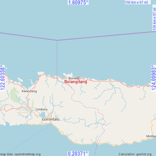
Bolangitang GPS coordinates[2]
0° 54' 24.48" North, 123° 18' 24.12" East
| Map corner | latitude | longitude |
|---|---|---|
| Upper-left | 1.60975°, | 122.60358° |
| Center: | 0.9068°, | 123.3067° |
| Lower-right: | 0.20371°, | 124.00983° |
| Map W x H: | 156.3×156.3 km | = 97.1×97.1mi |
| max Lat: | 5.88969° ⇑4% North |
| Bolangitang: | 0.9068° |
| min Lat: | ⇓96% South -10.934° |
| min Long | Bolangitang | max Long |
| 95.1345° | 123.3067° | 140.9419° |
| W 91.7%⇐ | ⇒8.3% E |
Elevation
Elevation of Bolangitang is 12 m = 39 ft, and this is 217.7 m = 714 ft below average elevation for this country.
| Max E: |
3185 m = 10449 ft | 87.7% |
| Avg. | 229.7 m = 754 ft | |
| Bolangitang | 12 m = 39 ft | |
Min E: |
-1 m = -3 ft | 12.3% |
See also: Indonesia elevation on elevation.city.
Geographical zone
Bolangitang is located in North Torrid zone (between Equator and Tropic of Cancer). Distance of Equator is 100.8 km =62.6 mi to South.| Distance of | km | miles | from Bolangitang |
|---|---|---|---|
| North Pole | 9906.2 | 6155.4 | to North |
| Arctic Circle | 7300.3 | 4536.2 | to North |
| Tropic Cancer | 2505.1 | 1556.6 | to North |
| Equator | 100.8 | 62.6 | to South |


Nearby cities:
15 places around Bolangitang: (largest is in red/bold)
• Bilungala
59.3 km =36.8 mi,  190°
190°
• Bolaang
94.5 km =58.7 mi,  87°
87°
• Boroko
4.3 km =2.7 mi,  272°
272°
• Dumoga
92.4 km =57.4 mi,  110°
110°
• Gorontalo
49.2 km =30.6 mi,  213°
213°
• Isimu
57.5 km =35.7 mi,  239°
239°
• Kwandang
44.3 km =27.5 mi,  259°
259°
• Limboto
48 km =29.8 mi,  229°
229°
• Lolak
78.2 km =48.6 mi, 92°
• Molibagu
94.8 km =58.9 mi,  127°
127°
• Molobulahe
86.9 km =54 mi,  249°
249°
• Payunga
54.9 km =34.1 mi, 225°
• Pimpi
27.2 km =16.9 mi,  95°
95°
• Sidomulyo
82 km =51 mi, 249°
• Suwawa
45.3 km =28.1 mi,  203°
203°
Sources, notices
• [Note1] Compared only with cities in Indonesia existing in our database
• [Src1] Map data: © OpenStreetMap contributors (CC-BY-SA)
• [Src2] Other city data from geonames.org with taken over terms of usage.
• [Src3] Geographical zone / Annual Mean Temperature by Robert A. Rohde @ Wikipedia
