Tanjung Selor geodata
Tanjung Selor (North Kalimantan) is a seat of a first-order administrative division; located in Indonesia in Asia/Makassar (GMT+8) time zone. In our database, there are 407 cities with bigger population. Compared to other cities in Indonesia, 97.8% of cities are located further ↓South; 78.9% of cities are located further ←West and 92.1% of cities have higher elevation than Tanjung Selor. Note1


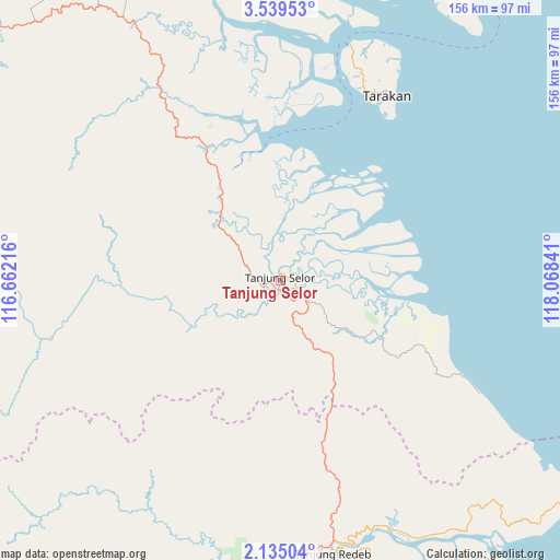
Tanjung Selor GPS coordinates[2]
2° 50' 15" North, 117° 21' 55.008" East
| Map corner | latitude | longitude |
|---|---|---|
| Upper-left | 3.53953°, | 116.66216° |
| Center: | 2.8375°, | 117.36528° |
| Lower-right: | 2.13504°, | 118.06841° |
| Map W x H: | 156.2×156.2 km | = 97.1×97.1mi |
| max Lat: | 5.88969° ⇑2.2% North |
| Tanjung Selor: | 2.8375° |
| min Lat: | ⇓97.8% South -10.934° |
| min Long | Tanjung Selor | max Long |
| 95.1345° | 117.36528° | 140.9419° |
| W 78.9%⇐ | ⇒21.1% E |
Elevation
Elevation of Tanjung Selor is 9 m = 30 ft, and this is 220.7 m = 724 ft below average elevation for this country.
| Max E: |
3185 m = 10449 ft | 92.1% |
| Avg. | 229.7 m = 754 ft | |
| Tanjung Selor | 9 m = 30 ft | |
Min E: |
-1 m = -3 ft | 7.9% |
See also: Indonesia elevation on elevation.city.
Geographical zone
Tanjung Selor is located in North Torrid zone (between Equator and Tropic of Cancer). Distance of Equator is 315.5 km =196 mi to South.| Distance of | km | miles | from Tanjung Selor |
|---|---|---|---|
| North Pole | 9691.6 | 6022.1 | to North |
| Arctic Circle | 7085.7 | 4402.8 | to North |
| Tropic Cancer | 2290.4 | 1423.2 | to North |
| Equator | 315.5 | 196 | to South |


Nearby cities:
15 places around Tanjung Selor: (largest is in red/bold)
• Atap
118.8 km =73.8 mi,  342°
342°
• Kerangagung
24.5 km =15.2 mi,  317°
317°
• Long Bang
51.2 km =31.8 mi,  271°
271°
• Long Beluah
31.9 km =19.8 mi,  254°
254°
• Long Loreh
106 km =65.9 mi,  290°
290°
• Long Peso
66.5 km =41.3 mi,  255°
255°
• Malinau
117.2 km =72.8 mi, 315°
• Mensalong
123.4 km =76.7 mi,  326°
326°
• Salinbatu
11.7 km =7.3 mi,  348°
348°
• Sebuku
134.6 km =83.6 mi, 344°
• Sekatak Bengara
32.5 km =20.2 mi, 328°
• Sesayap
92.1 km =57.2 mi, 334°
• Tanjung Palas
2.7 km =1.7 mi, 251°
• Tarakan
58.6 km =36.4 mi,  25°
25°
• Tideng Pale
99.7 km =62 mi, 329°
Sources, notices
• [Note1] Compared only with cities in Indonesia existing in our database
• [Src1] Map data: © OpenStreetMap contributors (CC-BY-SA)
• [Src2] Other city data from geonames.org with taken over terms of usage.
• [Src3] Geographical zone / Annual Mean Temperature by Robert A. Rohde @ Wikipedia
