Ennistimon geodata
Ennistimon (Munster) is a populated place; located in Ireland in Europe/Dublin (GMT+1) time zone. With population of 957 people, there are 359 cities with bigger population in this country. Compared to other cities in Ireland, 63.2% of cities are located further ↑North; 93.5% of cities are located further →East and 57.5% of cities have higher elevation than Ennistimon. Note1


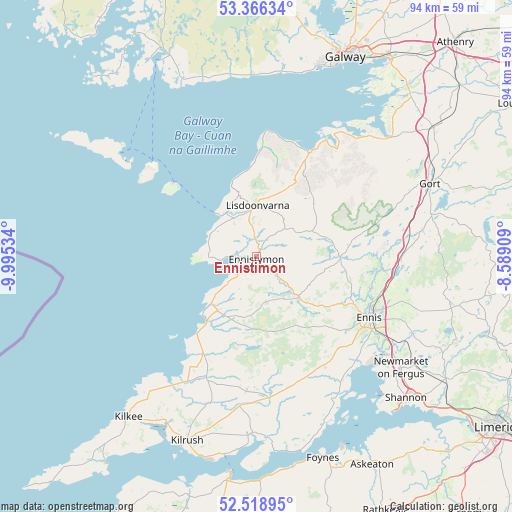
Ennistimon GPS coordinates[2]
52° 56' 40.992" North, 9° 17' 31.992" West
| Map corner | latitude | longitude |
|---|---|---|
| Upper-left | 53.36634°, | -9.99534° |
| Center: | 52.94472°, | -9.29222° |
| Lower-right: | 52.51895°, | -8.58909° |
| Map W x H: | 94.2×94.2 km | = 58.5×58.5mi |
| max Lat: | 55.25° ⇑63.2% North |
| Ennistimon: | 52.94472° |
| min Lat: | ⇓36.8% South 51.52487° |
| min Long | Ennistimon | max Long |
| -10.26889° | -9.29222° | -6.04944° |
| W 6.5%⇐ | ⇒93.5% E |
Elevation
Elevation of Ennistimon is 41 m = 135 ft, and this is 13.5 m = 44 ft below average elevation for this country.
| Max E: |
262 m = 860 ft | 57.5% |
| Avg. | 54.5 m = 179 ft | |
| Ennistimon | 41 m = 135 ft | |
Min E: |
0 m = 0 ft | 42.5% |
See also: Ireland elevation on elevation.city.
Geographical zone
Ennistimon is located in North temperate zone (between Tropic of Cancer and the Arctic Circle). Distance of this North polar circle is 1514.3 km =940.9 mi to North.| Distance of | km | miles | from Ennistimon |
|---|---|---|---|
| North Pole | 4120.2 | 2560.2 | to North |
| Arctic Circle | 1514.3 | 940.9 | to North |
| Tropic Cancer | 3281 | 2038.7 | to South |
| Equator | 5886.9 | 3657.9 | to South |


Nearby cities:
15 places around Ennistimon: (largest is in red/bold)
• Bearna
35.5 km =22.1 mi,  15°
15°
• Boston
26 km =16.2 mi,  68°
68°
• Corofin
15.4 km =9.6 mi,  88°
88°
• Ennis
23.4 km =14.5 mi,  118°
118°
• Foynes
39 km =24.2 mi,  161°
161°
• Gort
34.6 km =21.5 mi, 66°
• Kilrush
36.3 km =22.6 mi,  200°
200°
• Kinvarra
32.3 km =20.1 mi,  47°
47°
• Lehinch
3.3 km =2.1 mi,  245°
245°
• Lisdoonvarna
9.8 km =6.1 mi,  1°
1°
• Miltown Malbay
12.2 km =7.6 mi,  215°
215°
• Newmarket on Fergus
33.6 km =20.9 mi,  127°
127°
• Quin
31.8 km =19.8 mi, 116°
• Shannon
39.3 km =24.4 mi, 132°
• Tulla
36.7 km =22.8 mi,  104°
104°
Sources, notices
• [Note1] Compared only with cities in Ireland existing in our database
• [Src1] Map data: © OpenStreetMap contributors (CC-BY-SA)
• [Src2] Other city data from geonames.org with taken over terms of usage.
• [Src3] Geographical zone / Annual Mean Temperature by Robert A. Rohde @ Wikipedia
