Lehinch geodata
Lehinch (Munster) is a populated place; located in Ireland in Europe/Dublin (GMT+1) time zone. With population of 642 people, there are 459 cities with bigger population in this country. Compared to other cities in Ireland, 63.8% of cities are located further ↑North; 94.5% of cities are located further →East and 80.5% of cities have higher elevation than Lehinch. Note1


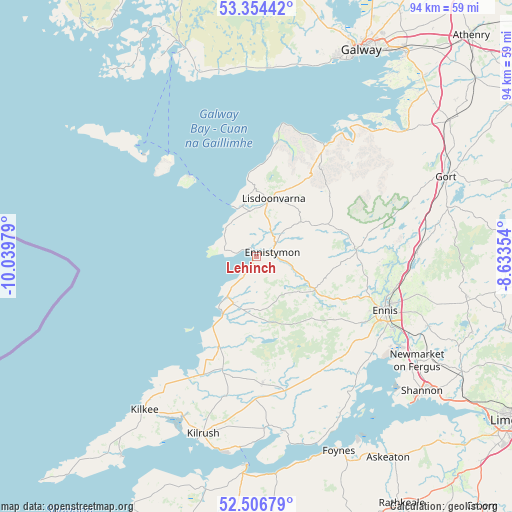
Lehinch GPS coordinates[2]
52° 55' 57.648" North, 9° 20' 11.976" West
| Map corner | latitude | longitude |
|---|---|---|
| Upper-left | 53.35442°, | -10.03979° |
| Center: | 52.93268°, | -9.33666° |
| Lower-right: | 52.50679°, | -8.63354° |
| Map W x H: | 94.2×94.2 km | = 58.5×58.5mi |
| max Lat: | 55.25° ⇑63.8% North |
| Lehinch: | 52.93268° |
| min Lat: | ⇓36.2% South 51.52487° |
| min Long | Lehinch | max Long |
| -10.26889° | -9.33666° | -6.04944° |
| W 5.5%⇐ | ⇒94.5% E |
Elevation
Elevation of Lehinch is 17 m = 56 ft, and this is 37.5 m = 123 ft below average elevation for this country.
| Max E: |
262 m = 860 ft | 80.5% |
| Avg. | 54.5 m = 179 ft | |
| Lehinch | 17 m = 56 ft | |
Min E: |
0 m = 0 ft | 19.5% |
See also: Ireland elevation on elevation.city.
Geographical zone
Lehinch is located in North temperate zone (between Tropic of Cancer and the Arctic Circle). Distance of this North polar circle is 1515.6 km =941.7 mi to North.| Distance of | km | miles | from Lehinch |
|---|---|---|---|
| North Pole | 4121.5 | 2561 | to North |
| Arctic Circle | 1515.6 | 941.7 | to North |
| Tropic Cancer | 3279.6 | 2037.8 | to South |
| Equator | 5885.6 | 3657.1 | to South |


Nearby cities:
15 places around Lehinch: (largest is in red/bold)
• Bearna
37.6 km =23.4 mi,  19°
19°
• Boston
29.2 km =18.1 mi,  68°
68°
• Corofin
18.4 km =11.4 mi,  84°
84°
• Ennis
25.5 km =15.8 mi,  112°
112°
• Ennistimon
3.3 km =2.1 mi, 65°
• Foynes
38.8 km =24.1 mi,  156°
156°
• Gort
37.8 km =23.5 mi, 66°
• Kilrush
34 km =21.1 mi,  196°
196°
• Kinvarra
35.4 km =22 mi,  49°
49°
• Lisdoonvarna
11.6 km =7.2 mi, 16°
• Miltown Malbay
9.5 km =5.9 mi,  205°
205°
• Newmarket on Fergus
35.3 km =21.9 mi,  122°
122°
• Quin
34 km =21.1 mi, 111°
• Tarbert
40.1 km =24.9 mi,  183°
183°
• Tulla
39.4 km =24.5 mi,  101°
101°
Sources, notices
• [Note1] Compared only with cities in Ireland existing in our database
• [Src1] Map data: © OpenStreetMap contributors (CC-BY-SA)
• [Src2] Other city data from geonames.org with taken over terms of usage.
• [Src3] Geographical zone / Annual Mean Temperature by Robert A. Rohde @ Wikipedia
