Ballycannan geodata
Ballycannan (Munster) is a populated place; located in Ireland in Europe/Dublin (GMT+1) time zone. With population of 646 people, there are 456 cities with bigger population in this country. Compared to other cities in Ireland, 71.9% of cities are located further ↑North; 80.3% of cities are located further →East and 73.1% of cities have higher elevation than Ballycannan. Note1


Ballycannan GPS coordinates[2]
52° 42' 7.164" North, 8° 39' 2.196" West
| Map corner | latitude | longitude |
|---|---|---|
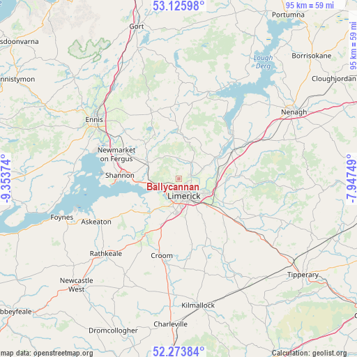
| Upper-left | 53.12598°, | -9.35374° |
| Center: | 52.70199°, | -8.65061° |
| Lower-right: | 52.27384°, | -7.94749° |
| Map W x H: | 94.7×94.7 km | = 58.8×58.8mi |
| max Lat: | 55.25° ⇑71.9% North |
| Ballycannan: | 52.70199° |
| min Lat: | ⇓28.1% South 51.52487° |
| min Long | Ballycannan | max Long |
| -10.26889° | -8.65061° | -6.04944° |
| W 19.7%⇐ | ⇒80.3% E |
Elevation
Elevation of Ballycannan is 24 m = 79 ft, and this is 30.5 m = 100 ft below average elevation for this country.
| Max E: |
262 m = 860 ft | 73.1% |
| Avg. | 54.5 m = 179 ft | |
| Ballycannan | 24 m = 79 ft | |
Min E: |
0 m = 0 ft | 26.9% |
See also: Ireland elevation on elevation.city.
Geographical zone
Ballycannan is located in North temperate zone (between Tropic of Cancer and the Arctic Circle). Distance of this North polar circle is 1541.3 km =957.7 mi to North.| Distance of | km | miles | from Ballycannan |
|---|---|---|---|
| North Pole | 4147.1 | 2576.9 | to North |
| Arctic Circle | 1541.3 | 957.7 | to North |
| Tropic Cancer | 3254 | 2021.9 | to South |
| Equator | 5859.9 | 3641.2 | to South |


Nearby cities:
15 places around Ballycannan: (largest is in red/bold)
• Annacotty
8.9 km =5.5 mi,  115°
115°
• Ardnacrusha
2.6 km =1.6 mi,  72°
72°
• Caherconlish
17.1 km =10.6 mi,  134°
134°
• Castleconnell
10.3 km =6.4 mi,  82°
82°
• Clonlara
7.1 km =4.4 mi, 69°
• Cratloe
7.4 km =4.6 mi,  263°
263°
• Kilkishen
13.3 km =8.3 mi,  331°
331°
• Luimneach
4.5 km =2.8 mi,  155°
155°
• Moyross
2.3 km =1.4 mi, 161°
• Newmarket on Fergus
17.7 km =11 mi,  291°
291°
• Newport
16.3 km =10.1 mi,  86°
86°
• Pallaskenry
16.1 km =10 mi,  245°
245°
• Patrickswell
12.3 km =7.6 mi,  198°
198°
• Shannon
14.4 km =8.9 mi,  270°
270°
• Sixmilebridge
9.4 km =5.8 mi,  297°
297°
Sources, notices
• [Note1] Compared only with cities in Ireland existing in our database
• [Src1] Map data: © OpenStreetMap contributors (CC-BY-SA)
• [Src2] Other city data from geonames.org with taken over terms of usage.
• [Src3] Geographical zone / Annual Mean Temperature by Robert A. Rohde @ Wikipedia
