Castleconnell geodata
Castleconnell (Munster) is a populated place; located in Ireland in Europe/Dublin (GMT+0) time zone. With population of 1,917 people, there are 234 cities with bigger population in this country. Compared to other cities in Ireland, 71% of cities are located further ↑North; 74.6% of cities are located further →East and 70.4% of cities have higher elevation than Castleconnell. Note1


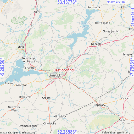
Castleconnell GPS coordinates[2]
52° 42' 50.004" North, 8° 29' 57.984" West
| Map corner | latitude | longitude |
|---|---|---|
| Upper-left | 53.13776°, | -9.20256° |
| Center: | 52.71389°, | -8.49944° |
| Lower-right: | 52.28586°, | -7.79631° |
| Map W x H: | 94.7×94.7 km | = 58.8×58.8mi |
| max Lat: | 55.25° ⇑71% North |
| Castleconnell: | 52.71389° |
| min Lat: | ⇓29% South 51.52487° |
| min Long | Castleconnell | max Long |
| -10.26889° | -8.49944° | -6.04944° |
| W 25.4%⇐ | ⇒74.6% E |
Elevation
Elevation of Castleconnell is 26 m = 85 ft, and this is 28.5 m = 94 ft below average elevation for this country.
| Max E: |
262 m = 860 ft | 70.4% |
| Avg. | 54.5 m = 179 ft | |
| Castleconnell | 26 m = 85 ft | |
Min E: |
0 m = 0 ft | 29.6% |
See also: Ireland elevation on elevation.city.
Geographical zone
Castleconnell is located in North temperate zone (between Tropic of Cancer and the Arctic Circle). Distance of this North polar circle is 1539.9 km =956.8 mi to North.| Distance of | km | miles | from Castleconnell |
|---|---|---|---|
| North Pole | 4145.8 | 2576.1 | to North |
| Arctic Circle | 1539.9 | 956.8 | to North |
| Tropic Cancer | 3255.3 | 2022.7 | to South |
| Equator | 5861.2 | 3642 | to South |


Nearby cities:
15 places around Castleconnell: (largest is in red/bold)
• Annacotty
5.6 km =3.5 mi,  202°
202°
• Ardnacrusha
7.8 km =4.8 mi,  266°
266°
• Ballina
11.3 km =7 mi,  22°
22°
• Ballycannan
10.3 km =6.4 mi,  262°
262°
• Caherconlish
13.5 km =8.4 mi,  171°
171°
• Cappamore
15.6 km =9.7 mi,  135°
135°
• Clonlara
3.8 km =2.4 mi,  288°
288°
• Cratloe
17.7 km =11 mi, 263°
• Killaloe
11 km =6.8 mi, 20°
• Luimneach
10 km =6.2 mi,  236°
236°
• Moroe
9.9 km =6.2 mi, 135°
• Moyross
10.1 km =6.3 mi,  249°
249°
• Newport
6.1 km =3.8 mi,  92°
92°
• Patrickswell
19.2 km =11.9 mi,  227°
227°
• Sixmilebridge
18.8 km =11.7 mi,  279°
279°
Sources, notices
• [Note1] Compared only with cities in Ireland existing in our database
• [Src1] Map data: © OpenStreetMap contributors (CC-BY-SA)
• [Src2] Other city data from geonames.org with taken over terms of usage.
• [Src3] Geographical zone / Annual Mean Temperature by Robert A. Rohde @ Wikipedia
