Midreshet Ben-Gurion geodata
Midreshet Ben-Gurion (Southern District) is a populated place; located in Israel in Asia/Jerusalem (GMT+3) time zone. With population of 1,100 people, there are 156 cities with bigger population in this country. Compared to other cities in Israel, 98.8% of cities are located further ↑North; 91.1% of cities are located further →East and 81.7% of cities have lower elevation than Midreshet Ben-Gurion. Note1


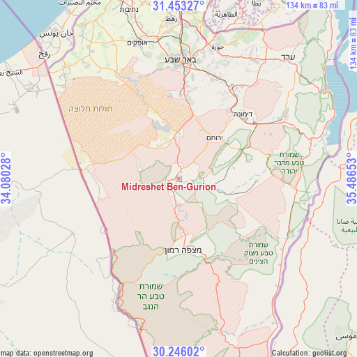
Midreshet Ben-Gurion GPS coordinates[2]
30° 51' 5.544" North, 34° 47' 0.24" East
| Map corner | latitude | longitude |
|---|---|---|
| Upper-left | 31.45327°, | 34.08028° |
| Center: | 30.85154°, | 34.7834° |
| Lower-right: | 30.24602°, | 35.48653° |
| Map W x H: | 134.2×134.2 km | = 83.4×83.4mi |
| max Lat: | 33.27918° ⇑98.8% North |
| Midreshet Ben-Gurion: | 30.85154° |
| min Lat: | ⇓1.2% South 29.55805° |
| min Long | Midreshet Ben-G | max Long |
| 34.57149° | 34.7834° | 35.81084° |
| W 8.9%⇐ | ⇒91.1% E |
Elevation
Elevation of Midreshet Ben-Gurion is 480 m = 1575 ft, and this is 256.6 m = 842 ft above average elevation for this country.
| Max E: |
988 m = 3241 ft | 18.3% |
| Midreshet Ben-Gurion | 480 m 1575 ft | |
| Avg. | 223.4 m = 733 ft | |
Min E: |
-380 m = -1247 ft | 81.7% |
See also: Israel elevation on elevation.city.
Geographical zone
Midreshet Ben-Gurion is located in North temperate zone (between Tropic of Cancer and the Arctic Circle). Distance of this Northern Tropic circle is 824.5 km =512.3 mi to South.| Distance of | km | miles | from Midreshet Ben-Gurion |
|---|---|---|---|
| North Pole | 6576.7 | 4086.6 | to North |
| Arctic Circle | 3970.8 | 2467.3 | to North |
| Tropic Cancer | 824.5 | 512.3 | to South |
| Equator | 3430.4 | 2131.6 | to South |


Nearby cities:
15 places around Midreshet Ben-Gurion: (largest is in red/bold)
• Arad
61 km =37.9 mi,  42°
42°
• Ashkelon
93.1 km =57.8 mi,  347°
347°
• Beersheba
44.5 km =27.7 mi,  0°
0°
• Bet Shemesh
99.8 km =62 mi,  11°
11°
• Dimona
34 km =21.1 mi, 44°
• Lehavim
58 km =36 mi, 3°
• Mitzpe Ramon
27 km =16.8 mi,  176°
176°
• Netivot
66.2 km =41.1 mi,  343°
343°
• Ofaqim
53.7 km =33.4 mi, 343°
• Qiryat Gat
84.4 km =52.4 mi,  358°
358°
• Rahat
60.5 km =37.6 mi, 357°
• Sederot
77 km =47.8 mi, 346°
• Yeroẖam
20.8 km =12.9 mi, 42°
• ‘En Boqeq
67.4 km =41.9 mi,  54°
54°
• ‘En Gedi
87.9 km =54.6 mi, 40°
Sources, notices
• [Note1] Compared only with cities in Israel existing in our database
• [Src1] Map data: © OpenStreetMap contributors (CC-BY-SA)
• [Src2] Other city data from geonames.org with taken over terms of usage.
• [Src3] Geographical zone / Annual Mean Temperature by Robert A. Rohde @ Wikipedia
