Mitzpe Ramon geodata
Mitzpe Ramon (Southern District) is a populated place; located in Israel in Asia/Jerusalem (GMT+3) time zone. With population of 4,769 people, there are 112 cities with bigger population in this country. Compared to other cities in Israel, 99.4% of cities are located further ↑North; 88.8% of cities are located further →East and 98.2% of cities have lower elevation than Mitzpe Ramon. Note1


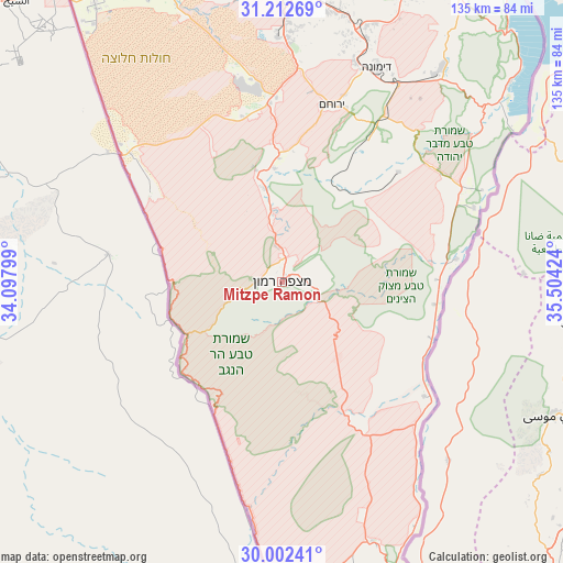
Mitzpe Ramon GPS coordinates[2]
30° 36' 33.984" North, 34° 48' 3.996" East
| Map corner | latitude | longitude |
|---|---|---|
| Upper-left | 31.21269°, | 34.09799° |
| Center: | 30.60944°, | 34.80111° |
| Lower-right: | 30.00241°, | 35.50424° |
| Map W x H: | 134.6×134.6 km | = 83.6×83.6mi |
| max Lat: | 33.27918° ⇑99.4% North |
| Mitzpe Ramon: | 30.60944° |
| min Lat: | ⇓0.6% South 29.55805° |
| min Long | Mitzpe Ramon | max Long |
| 34.57149° | 34.80111° | 35.81084° |
| W 11.2%⇐ | ⇒88.8% E |
Elevation
Elevation of Mitzpe Ramon is 858 m = 2815 ft, and this is 634.6 m = 2082 ft above average elevation for this country.
| Max E: |
988 m = 3241 ft | 1.8% |
| Mitzpe Ramon | 858 m 2815 ft | |
| Avg. | 223.4 m = 733 ft | |
Min E: |
-380 m = -1247 ft | 98.2% |
See also: Israel elevation on elevation.city.
Geographical zone
Mitzpe Ramon is located in North temperate zone (between Tropic of Cancer and the Arctic Circle). Distance of this Northern Tropic circle is 797.5 km =495.5 mi to South.| Distance of | km | miles | from Mitzpe Ramon |
|---|---|---|---|
| North Pole | 6603.6 | 4103.3 | to North |
| Arctic Circle | 3997.7 | 2484.1 | to North |
| Tropic Cancer | 797.5 | 495.5 | to South |
| Equator | 3403.5 | 2114.8 | to South |


Nearby cities:
15 places around Mitzpe Ramon: (largest is in red/bold)
• Arad
82.2 km =51.1 mi,  28°
28°
• Ashkelon
119.8 km =74.4 mi,  349°
349°
• Beersheba
71.4 km =44.4 mi,  359°
359°
• Dimona
55.9 km =34.7 mi,  23°
23°
• Eilat
117.8 km =73.2 mi,  173°
173°
• Lehavim
84.9 km =52.8 mi,  0°
0°
• Midreshet Ben-Gurion
27 km =16.8 mi, 356°
• Netivot
92.7 km =57.6 mi, 347°
• Ofaqim
80.2 km =49.8 mi, 347°
• Qiryat Gat
111.3 km =69.2 mi, 358°
• Rahat
87.5 km =54.4 mi, 357°
• Sederot
103.6 km =64.4 mi, 349°
• Yeroẖam
43.9 km =27.3 mi, 16°
• ‘En Boqeq
84.7 km =52.6 mi,  39°
39°
• ‘En Gedi
109 km =67.7 mi, 30°
Sources, notices
• [Note1] Compared only with cities in Israel existing in our database
• [Src1] Map data: © OpenStreetMap contributors (CC-BY-SA)
• [Src2] Other city data from geonames.org with taken over terms of usage.
• [Src3] Geographical zone / Annual Mean Temperature by Robert A. Rohde @ Wikipedia
