Yavne’el geodata
Yavne’el (Northern District) is a populated place; located in Israel in Asia/Jerusalem (GMT+3) time zone. With population of 2,900 people, there are 123 cities with bigger population in this country. Compared to other cities in Israel, 67.5% of cities are located further ↓South; 95.3% of cities are located further ←West and 97% of cities have higher elevation than Yavne’el. Note1


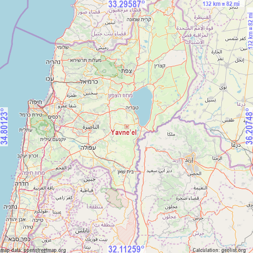
Yavne’el GPS coordinates[2]
32° 42' 22.284" North, 35° 30' 15.66" East
| Map corner | latitude | longitude |
|---|---|---|
| Upper-left | 33.29587°, | 34.80123° |
| Center: | 32.70619°, | 35.50435° |
| Lower-right: | 32.11259°, | 36.20748° |
| Map W x H: | 131.6×131.6 km | = 81.8×81.8mi |
| max Lat: | 33.27918° ⇑32.5% North |
| Yavne’el: | 32.70619° |
| min Lat: | ⇓67.5% South 29.55805° |
| min Long | Yavne’el | max Long |
| 34.57149° | 35.50435° | 35.81084° |
| W 95.3%⇐ | ⇒4.7% E |
Elevation
Elevation of Yavne’el is -18 m = -59 ft, and this is 241.4 m = 792 ft below average elevation for this country.
| Max E: |
988 m = 3241 ft | 97% |
| Avg. | 223.4 m = 733 ft | |
| Yavne’el | -18 m = -59 ft | |
Min E: |
-380 m = -1247 ft | 3% |
See also: Israel elevation on elevation.city.
Geographical zone
Yavne’el is located in North temperate zone (between Tropic of Cancer and the Arctic Circle). Distance of this Northern Tropic circle is 1030.7 km =640.4 mi to South.| Distance of | km | miles | from Yavne’el |
|---|---|---|---|
| North Pole | 6370.5 | 3958.4 | to North |
| Arctic Circle | 3764.6 | 2339.2 | to North |
| Tropic Cancer | 1030.7 | 640.4 | to South |
| Equator | 3636.6 | 2259.7 | to South |


Nearby cities:
15 places around Yavne’el: (largest is in red/bold)
• Bu‘eina
17.2 km =10.7 mi,  310°
310°
• Dabbūrīya
12.5 km =7.8 mi,  263°
263°
• Er Reina
17.7 km =11 mi,  276°
276°
• Iksāl
17.1 km =10.6 mi, 260°
• Kafr Kammā
6.1 km =3.8 mi,  285°
285°
• Kafr Kannā
15.8 km =9.8 mi, 286°
• Kafr Miṣr
10.3 km =6.4 mi,  228°
228°
• Kefar Tavor
8.1 km =5 mi,  254°
254°
• Nazareth
19.4 km =12.1 mi,  268°
268°
• Nein
16.8 km =10.4 mi,  240°
240°
• Shibli
10.5 km =6.5 mi, 263°
• Sūlam
19.4 km =12.1 mi, 235°
• Tiberias
9.9 km =6.2 mi,  14°
14°
• ‘Eilabun
17.5 km =10.9 mi,  326°
326°
• ‘Uzeir
18.9 km =11.7 mi,  300°
300°
Sources, notices
• [Note1] Compared only with cities in Israel existing in our database
• [Src1] Map data: © OpenStreetMap contributors (CC-BY-SA)
• [Src2] Other city data from geonames.org with taken over terms of usage.
• [Src3] Geographical zone / Annual Mean Temperature by Robert A. Rohde @ Wikipedia
