Umm el Faḥm geodata
Umm el Faḥm (Haifa) is a populated place; located in Israel in Asia/Jerusalem (GMT+3) time zone. With population of 41,030 people, there are 35 cities with bigger population in this country. Compared to other cities in Israel, 57.4% of cities are located further ↓South; 63.9% of cities are located further ←West and 78.7% of cities have lower elevation than Umm el Faḥm. Note1


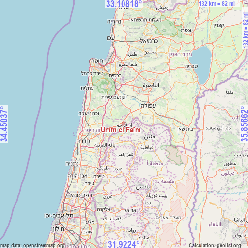
Umm el Faḥm GPS coordinates[2]
32° 31' 2.1" North, 35° 9' 12.564" East
| Map corner | latitude | longitude |
|---|---|---|
| Upper-left | 33.10818°, | 34.45037° |
| Center: | 32.51725°, | 35.15349° |
| Lower-right: | 31.9224°, | 35.85662° |
| Map W x H: | 131.8×131.8 km | = 81.9×81.9mi |
| max Lat: | 33.27918° ⇑42.6% North |
| Umm el Faḥm: | 32.51725° |
| min Lat: | ⇓57.4% South 29.55805° |
| min Long | Umm el Faḥm | max Long |
| 34.57149° | 35.15349° | 35.81084° |
| W 63.9%⇐ | ⇒36.1% E |
Elevation
Elevation of Umm el Faḥm is 398 m = 1306 ft, and this is 174.6 m = 573 ft above average elevation for this country.
| Max E: |
988 m = 3241 ft | 21.3% |
| Umm el Faḥm | 398 m 1306 ft | |
| Avg. | 223.4 m = 733 ft | |
Min E: |
-380 m = -1247 ft | 78.7% |
See also: Umm el Faḥm elevation on elevation.city.
Geographical zone
Umm el Faḥm is located in North temperate zone (between Tropic of Cancer and the Arctic Circle). Distance of this Northern Tropic circle is 1009.7 km =627.4 mi to South.| Distance of | km | miles | from Umm el Faḥm |
|---|---|---|---|
| North Pole | 6391.5 | 3971.5 | to North |
| Arctic Circle | 3785.6 | 2352.3 | to North |
| Tropic Cancer | 1009.7 | 627.4 | to South |
| Equator | 3615.6 | 2246.6 | to South |


Nearby cities:
15 places around Umm el Faḥm: (largest is in red/bold)
• Afula
16.3 km =10.1 mi,  51°
51°
• Basmat Ṭab‘ūn
24.7 km =15.3 mi,  0°
0°
• Caesarea
23.3 km =14.5 mi,  270°
270°
• Daliyat al Karmel
22 km =13.7 mi,  333°
333°
• El Fureidīs
21 km =13 mi,  295°
295°
• Elyakhin
24.7 km =15.3 mi,  240°
240°
• Hadera
24.9 km =15.5 mi,  250°
250°
• Iksāl
24.3 km =15.1 mi,  41°
41°
• Migdal Ha‘Emeq
19.4 km =12.1 mi,  24°
24°
• Nazareth
24.4 km =15.2 mi,  33°
33°
• Nein
22.2 km =13.8 mi,  55°
55°
• Ramat Yishay
20.9 km =13 mi, 4°
• Rekhasim
26.3 km =16.3 mi,  348°
348°
• Sūlam
19.6 km =12.2 mi, 59°
• Timrat
21.7 km =13.5 mi, 17°
Sources, notices
• [Note1] Compared only with cities in Israel existing in our database
• [Src1] Map data: © OpenStreetMap contributors (CC-BY-SA)
• [Src2] Other city data from geonames.org with taken over terms of usage.
• [Src3] Geographical zone / Annual Mean Temperature by Robert A. Rohde @ Wikipedia
