Nordiyya geodata
Nordiyya (Central District) is a populated place; located in Israel in Asia/Jerusalem (GMT+3) time zone. With population of 2,264 people, there are 139 cities with bigger population in this country. Compared to other cities in Israel, 53.3% of cities are located further ↓South; 72.2% of cities are located further →East and 76.3% of cities have higher elevation than Nordiyya. Note1


Nordiyya GPS coordinates[2]
32° 18' 52.92" North, 34° 53' 46.212" East
| Map corner | latitude | longitude |
|---|---|---|
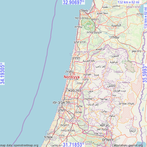
| Upper-left | 32.90697°, | 34.19305° |
| Center: | 32.3147°, | 34.89617° |
| Lower-right: | 31.71853°, | 35.5993° |
| Map W x H: | 132.1×132.1 km | = 82.1×82.1mi |
| max Lat: | 33.27918° ⇑46.7% North |
| Nordiyya: | 32.3147° |
| min Lat: | ⇓53.3% South 29.55805° |
| min Long | Nordiyya | max Long |
| 34.57149° | 34.89617° | 35.81084° |
| W 27.8%⇐ | ⇒72.2% E |
Elevation
Elevation of Nordiyya is 45 m = 148 ft, and this is 178.4 m = 585 ft below average elevation for this country.
| Max E: |
988 m = 3241 ft | 76.3% |
| Avg. | 223.4 m = 733 ft | |
| Nordiyya | 45 m = 148 ft | |
Min E: |
-380 m = -1247 ft | 23.7% |
See also: Israel elevation on elevation.city.
Geographical zone
Nordiyya is located in North temperate zone (between Tropic of Cancer and the Arctic Circle). Distance of this Northern Tropic circle is 987.1 km =613.4 mi to South.| Distance of | km | miles | from Nordiyya |
|---|---|---|---|
| North Pole | 6414 | 3985.5 | to North |
| Arctic Circle | 3808.1 | 2366.2 | to North |
| Tropic Cancer | 987.1 | 613.4 | to South |
| Equator | 3593.1 | 2232.6 | to South |


Nearby cities:
15 places around Nordiyya: (largest is in red/bold)
• Bet Yiẕẖaq
1.6 km =1 mi,  334°
334°
• Elyakhin
10.7 km =6.6 mi,  14°
14°
• Even Yehuda
5.1 km =3.2 mi,  189°
189°
• Eṭ Ṭaiyiba
11.9 km =7.4 mi,  116°
116°
• Hadera
14.2 km =8.8 mi,  2°
2°
• Kefar Shemaryahu
16 km =9.9 mi,  206°
206°
• Kefar Yona
3.7 km =2.3 mi,  86°
86°
• Kfar Saba
15.6 km =9.7 mi,  176°
176°
• Netanya
4 km =2.5 mi,  300°
300°
• Pardesiyya
1.6 km =1 mi,  129°
129°
• Qalansuwa
8.6 km =5.3 mi,  112°
112°
• Ra'anana
14.7 km =9.1 mi, 188°
• Tel Mond
7.5 km =4.7 mi,  164°
164°
• Tirah
10.3 km =6.4 mi,  150°
150°
• Ẕur Moshe
2.4 km =1.5 mi,  139°
139°
Sources, notices
• [Note1] Compared only with cities in Israel existing in our database
• [Src1] Map data: © OpenStreetMap contributors (CC-BY-SA)
• [Src2] Other city data from geonames.org with taken over terms of usage.
• [Src3] Geographical zone / Annual Mean Temperature by Robert A. Rohde @ Wikipedia
