Mi‘ilyā geodata
Mi‘ilyā (Northern District) is a section of populated place; located in Israel in Asia/Jerusalem (GMT+3) time zone. With population of 2,700 people, there are 127 cities with bigger population in this country. Compared to other cities in Israel, 96.4% of cities are located further ↓South; 73.4% of cities are located further ←West and 84% of cities have lower elevation than Mi‘ilyā. Note1


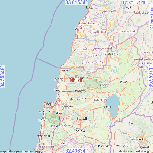
Mi‘ilyā GPS coordinates[2]
33° 1' 40.116" North, 35° 15' 23.688" East
| Map corner | latitude | longitude |
|---|---|---|
| Upper-left | 33.61534°, | 34.55346° |
| Center: | 33.02781°, | 35.25658° |
| Lower-right: | 32.43634°, | 35.95971° |
| Map W x H: | 131.1×131.1 km | = 81.5×81.5mi |
| max Lat: | 33.27918° ⇑3.6% North |
| Mi‘ilyā: | 33.02781° |
| min Lat: | ⇓96.4% South 29.55805° |
| min Long | Mi‘ilyā | max Long |
| 34.57149° | 35.25658° | 35.81084° |
| W 73.4%⇐ | ⇒26.6% E |
Elevation
Elevation of Mi‘ilyā is 525 m = 1722 ft, and this is 301.6 m = 990 ft above average elevation for this country.
| Max E: |
988 m = 3241 ft | 16% |
| Mi‘ilyā | 525 m 1722 ft | |
| Avg. | 223.4 m = 733 ft | |
Min E: |
-380 m = -1247 ft | 84% |
See also: Israel elevation on elevation.city.
Geographical zone
Mi‘ilyā is located in North temperate zone (between Tropic of Cancer and the Arctic Circle). Distance of this Northern Tropic circle is 1066.4 km =662.6 mi to South.| Distance of | km | miles | from Mi‘ilyā |
|---|---|---|---|
| North Pole | 6334.7 | 3936.2 | to North |
| Arctic Circle | 3728.8 | 2317 | to North |
| Tropic Cancer | 1066.4 | 662.6 | to South |
| Equator | 3672.3 | 2281.9 | to South |


Nearby cities:
15 places around Mi‘ilyā: (largest is in red/bold)
• Beit Jann
13.6 km =8.5 mi,  121°
121°
• Buqei‘a
9.1 km =5.7 mi,  127°
127°
• Esh Sheikh Dannūn
10.8 km =6.7 mi,  249°
249°
• Judeida Makr
14.5 km =9 mi,  219°
219°
• Karmi’el
13.1 km =8.1 mi,  159°
159°
• Kefar Rosh HaNiqra
14.8 km =9.2 mi,  295°
295°
• Kefar Weradim
4.3 km =2.7 mi,  152°
152°
• Kfar Yasif
12 km =7.5 mi,  227°
227°
• Nahariyya
14.9 km =9.3 mi,  261°
261°
• Naḥf
11.8 km =7.3 mi, 151°
• Pasuta
5.4 km =3.4 mi,  64°
64°
• Shelomi
11.5 km =7.1 mi, 295°
• Sājūr
12.3 km =7.6 mi,  140°
140°
• maalot Tarshīhā
1.6 km =1 mi, 142°
• Ḥurfeish
8.6 km =5.3 mi,  97°
97°
Sources, notices
• [Note1] Compared only with cities in Israel existing in our database
• [Src1] Map data: © OpenStreetMap contributors (CC-BY-SA)
• [Src2] Other city data from geonames.org with taken over terms of usage.
• [Src3] Geographical zone / Annual Mean Temperature by Robert A. Rohde @ Wikipedia
