Shelomi geodata
Shelomi (Northern District) is a populated place; located in Israel in Asia/Jerusalem (GMT+3) time zone. With population of 5,608 people, there are 104 cities with bigger population in this country. Compared to other cities in Israel, 97.6% of cities are located further ↓South; 62.1% of cities are located further ←West and 56.8% of cities have higher elevation than Shelomi. Note1


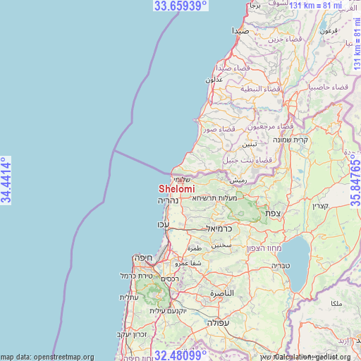
Shelomi GPS coordinates[2]
33° 4' 19.776" North, 35° 8' 40.272" East
| Map corner | latitude | longitude |
|---|---|---|
| Upper-left | 33.65939°, | 34.4414° |
| Center: | 33.07216°, | 35.14452° |
| Lower-right: | 32.48099°, | 35.84765° |
| Map W x H: | 131×131 km | = 81.4×81.4mi |
| max Lat: | 33.27918° ⇑2.4% North |
| Shelomi: | 33.07216° |
| min Lat: | ⇓97.6% South 29.55805° |
| min Long | Shelomi | max Long |
| 34.57149° | 35.14452° | 35.81084° |
| W 62.1%⇐ | ⇒37.9% E |
Elevation
Elevation of Shelomi is 82 m = 269 ft, and this is 141.4 m = 464 ft below average elevation for this country.
| Max E: |
988 m = 3241 ft | 56.8% |
| Avg. | 223.4 m = 733 ft | |
| Shelomi | 82 m = 269 ft | |
Min E: |
-380 m = -1247 ft | 43.2% |
See also: Israel elevation on elevation.city.
Geographical zone
Shelomi is located in North temperate zone (between Tropic of Cancer and the Arctic Circle). Distance of this Northern Tropic circle is 1071.4 km =665.7 mi to South.| Distance of | km | miles | from Shelomi |
|---|---|---|---|
| North Pole | 6329.8 | 3933.2 | to North |
| Arctic Circle | 3723.9 | 2313.9 | to North |
| Tropic Cancer | 1071.4 | 665.7 | to South |
| Equator | 3677.3 | 2285 | to South |


Nearby cities:
15 places around Shelomi: (largest is in red/bold)
• Acre
17.2 km =10.7 mi,  201°
201°
• Buqei‘a
20.5 km =12.7 mi,  120°
120°
• El Mazra‘a
10.8 km =6.7 mi, 203°
• Esh Sheikh Dannūn
8.7 km =5.4 mi,  177°
177°
• Judeida Makr
16 km =9.9 mi, 175°
• Karmi’el
22.8 km =14.2 mi,  139°
139°
• Kefar Rosh HaNiqra
3.3 km =2.1 mi,  298°
298°
• Kefar Weradim
15.2 km =9.4 mi, 124°
• Kfar Yasif
13.2 km =8.2 mi,  172°
172°
• Mi‘ilyā
11.5 km =7.1 mi, 115°
• Nahariyya
8.3 km =5.2 mi,  211°
211°
• Naḥf
22.2 km =13.8 mi,  133°
133°
• Pasuta
15.5 km =9.6 mi,  99°
99°
• maalot Tarshīhā
12.9 km =8 mi, 118°
• Ḥurfeish
20 km =12.4 mi,  107°
107°
Sources, notices
• [Note1] Compared only with cities in Israel existing in our database
• [Src1] Map data: © OpenStreetMap contributors (CC-BY-SA)
• [Src2] Other city data from geonames.org with taken over terms of usage.
• [Src3] Geographical zone / Annual Mean Temperature by Robert A. Rohde @ Wikipedia
