Sājūr geodata
Sājūr (Northern District) is a populated place; located in Israel in Asia/Jerusalem (GMT+3) time zone. With population of 3,547 people, there are 118 cities with bigger population in this country. Compared to other cities in Israel, 88.2% of cities are located further ↓South; 83.4% of cities are located further ←West and 76.9% of cities have lower elevation than Sājūr. Note1


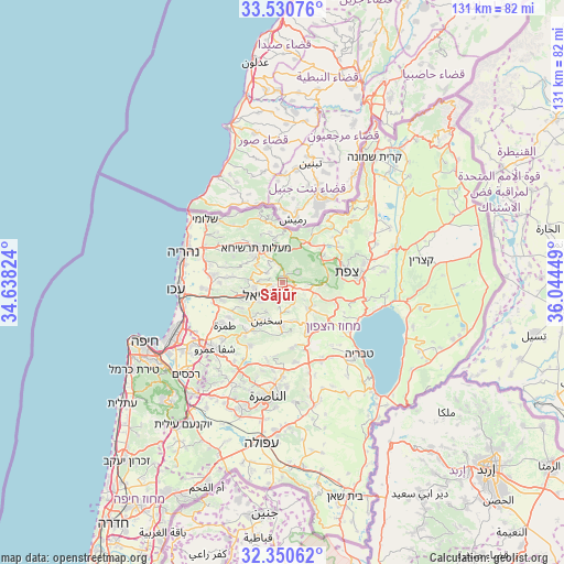
Sājūr GPS coordinates[2]
32° 56' 33.576" North, 35° 20' 28.896" East
| Map corner | latitude | longitude |
|---|---|---|
| Upper-left | 33.53076°, | 34.63824° |
| Center: | 32.94266°, | 35.34136° |
| Lower-right: | 32.35062°, | 36.04449° |
| Map W x H: | 131.2×131.2 km | = 81.5×81.5mi |
| max Lat: | 33.27918° ⇑11.8% North |
| Sājūr: | 32.94266° |
| min Lat: | ⇓88.2% South 29.55805° |
| min Long | Sājūr | max Long |
| 34.57149° | 35.34136° | 35.81084° |
| W 83.4%⇐ | ⇒16.6% E |
Elevation
Elevation of Sājūr is 375 m = 1230 ft, and this is 151.6 m = 497 ft above average elevation for this country.
| Max E: |
988 m = 3241 ft | 23.1% |
| Sājūr | 375 m 1230 ft | |
| Avg. | 223.4 m = 733 ft | |
Min E: |
-380 m = -1247 ft | 76.9% |
See also: Israel elevation on elevation.city.
Geographical zone
Sājūr is located in North temperate zone (between Tropic of Cancer and the Arctic Circle). Distance of this Northern Tropic circle is 1057 km =656.8 mi to South.| Distance of | km | miles | from Sājūr |
|---|---|---|---|
| North Pole | 6344.2 | 3942.1 | to North |
| Arctic Circle | 3738.3 | 2322.9 | to North |
| Tropic Cancer | 1057 | 656.8 | to South |
| Equator | 3662.9 | 2276 | to South |


Nearby cities:
15 places around Sājūr: (largest is in red/bold)
• Beit Jann
4.5 km =2.8 mi,  56°
56°
• Buqei‘a
3.9 km =2.4 mi,  349°
349°
• Deir Ḥannā
9.2 km =5.7 mi,  166°
166°
• Jīsh
13.2 km =8.2 mi,  48°
48°
• Karmi’el
4.4 km =2.7 mi,  230°
230°
• Kefar Weradim
8.2 km =5.1 mi,  313°
313°
• Maghār
8.5 km =5.3 mi,  133°
133°
• Mi‘ilyā
12.3 km =7.6 mi,  320°
320°
• Naḥf
2.5 km =1.6 mi,  248°
248°
• Pasuta
12.2 km =7.6 mi, 345°
• Sakhnīn
9.7 km =6 mi,  205°
205°
• Sallama
6 km =3.7 mi,  154°
154°
• maalot Tarshīhā
10.8 km =6.7 mi, 319°
• Ḥurfeish
8.3 km =5.2 mi,  4°
4°
• ‘Eilabun
13 km =8.1 mi, 154°
Sources, notices
• [Note1] Compared only with cities in Israel existing in our database
• [Src1] Map data: © OpenStreetMap contributors (CC-BY-SA)
• [Src2] Other city data from geonames.org with taken over terms of usage.
• [Src3] Geographical zone / Annual Mean Temperature by Robert A. Rohde @ Wikipedia
