Aistala geodata
Aistala (West Bengal) is a populated place; located in India in Asia/Kolkata (GMT+5.5) time zone. With population of 19,425 people, there are 2080 cities with bigger population in this country. Compared to other cities in India, 52.8% of cities are located further ↓South; 94.5% of cities are located further ←West and 91.1% of cities have higher elevation than Aistala. Note1


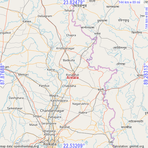
Aistala GPS coordinates[2]
23° 10' 48" North, 88° 34' 48" East
| Map corner | latitude | longitude |
|---|---|---|
| Upper-left | 23.82479°, | 87.87688° |
| Center: | 23.18°, | 88.58° |
| Lower-right: | 22.53209°, | 89.28313° |
| Map W x H: | 143.7×143.7 km | = 89.3×89.3mi |
| max Lat: | 34.9274° ⇑47.2% North |
| Aistala: | 23.18° |
| min Lat: | ⇓52.8% South 8.09008° |
| min Long | Aistala | max Long |
| 68.82655° | 88.58° | 96.81° |
| W 94.5%⇐ | ⇒5.5% E |
Elevation
Elevation of Aistala is 16 m = 52 ft, and this is 279.6 m = 917 ft below average elevation for this country.
| Max E: |
3681 m = 12077 ft | 91.1% |
| Avg. | 295.6 m = 970 ft | |
| Aistala | 16 m = 52 ft | |
Min E: |
1 m = 3 ft | 8.9% |
See also: India elevation on elevation.city.
Geographical zone
Aistala is located in North Torrid zone (between Equator and Tropic of Cancer). Distance of this Northern Tropic circle is 28.5 km =17.7 mi to North.| Distance of | km | miles | from Aistala |
|---|---|---|---|
| North Pole | 7429.7 | 4616.6 | to North |
| Arctic Circle | 4823.8 | 2997.4 | to North |
| Tropic Cancer | 28.5 | 17.7 | to North |
| Equator | 2577.4 | 1601.5 | to South |


Nearby cities:
15 places around Aistala: (largest is in red/bold)
• Bagulā
18.5 km =11.5 mi,  19°
19°
• Bangaon
29.7 km =18.5 mi,  120°
120°
• Bānsbāria
31.1 km =19.3 mi,  216°
216°
• Haringhāta
23.9 km =14.9 mi,  181°
181°
• Hālīsahar
32.1 km =19.9 mi,  210°
210°
• Kalyani
24 km =14.9 mi,  204°
204°
• Krishnanagar
26.7 km =16.6 mi,  340°
340°
• Kālna
22.6 km =14 mi,  281°
281°
• Kānchrāpāra
29 km =18 mi, 212°
• Madanpur
21.4 km =13.3 mi, 205°
• Nagarukhra
27.2 km =16.9 mi,  167°
167°
• Navadwīp
33.2 km =20.6 mi,  319°
319°
• Pandua
32.2 km =20 mi,  248°
248°
• Rānāghāt
1.4 km =0.9 mi, 252°
• Shāntipur
16.8 km =10.4 mi,  296°
296°
Sources, notices
• [Note1] Compared only with cities in India existing in our database
• [Src1] Map data: © OpenStreetMap contributors (CC-BY-SA)
• [Src2] Other city data from geonames.org with taken over terms of usage.
• [Src3] Geographical zone / Annual Mean Temperature by Robert A. Rohde @ Wikipedia
