Verāval geodata
Verāval (Gujarat) is a seat of a second-order administrative division; located in India in Asia/Kolkata (GMT+5.5) time zone. With population of 163,326 people, there are 266 cities with bigger population in this country. Compared to other cities in India, 62% of cities are located further ↑North; 99.1% of cities are located further →East and 96.4% of cities have higher elevation than Verāval. Note1


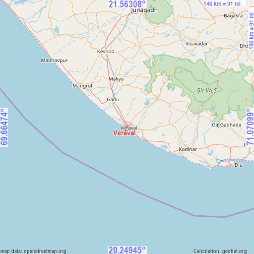
Verāval GPS coordinates[2]
20° 54' 27.72" North, 70° 22' 4.296" East
| Map corner | latitude | longitude |
|---|---|---|
| Upper-left | 21.56308°, | 69.66474° |
| Center: | 20.9077°, | 70.36786° |
| Lower-right: | 20.24945°, | 71.07099° |
| Map W x H: | 146.1×146.1 km | = 90.8×90.8mi |
| max Lat: | 34.9274° ⇑62% North |
| Verāval: | 20.9077° |
| min Lat: | ⇓38% South 8.09008° |
| min Long | Verāval | max Long |
| 68.82655° | 70.36786° | 96.81° |
| W 0.9%⇐ | ⇒99.1% E |
Elevation
Elevation of Verāval is 10 m = 33 ft, and this is 285.6 m = 937 ft below average elevation for this country.
| Max E: |
3681 m = 12077 ft | 96.4% |
| Avg. | 295.6 m = 970 ft | |
| Verāval | 10 m = 33 ft | |
Min E: |
1 m = 3 ft | 3.6% |
See also: Verāval elevation on elevation.city.
Geographical zone
Verāval is located in North Torrid zone (between Equator and Tropic of Cancer). Distance of this Northern Tropic circle is 281.2 km =174.7 mi to North.| Distance of | km | miles | from Verāval |
|---|---|---|---|
| North Pole | 7682.3 | 4773.6 | to North |
| Arctic Circle | 5076.5 | 3154.4 | to North |
| Tropic Cancer | 281.2 | 174.7 | to North |
| Equator | 2324.7 | 1444.5 | to South |


Nearby cities:
15 places around Verāval: (largest is in red/bold)
• Bagasra
88.6 km =55.1 mi,  43°
43°
• Bilkha
64.1 km =39.8 mi,  22°
22°
• Bāntva
71.3 km =44.3 mi,  334°
334°
• Delvāda
72 km =44.7 mi,  101°
101°
• Dhāri
82.8 km =51.4 mi,  55°
55°
• Diu
67.4 km =41.9 mi,  108°
108°
• Jūnāgadh
68.7 km =42.7 mi,  7°
7°
• Keshod
45.7 km =28.4 mi,  344°
344°
• Kodīnar
37 km =23 mi, 110°
• Kutiyāna
89 km =55.3 mi, 333°
• Mendarda
46.6 km =29 mi, 9°
• Māngrol
35.5 km =22.1 mi,  312°
312°
• Mānāvadar
69.8 km =43.4 mi, 340°
• Una
70.3 km =43.7 mi, 97°
• Vīsāvadar
62.2 km =38.6 mi, 39°
Sources, notices
• [Note1] Compared only with cities in India existing in our database
• [Src1] Map data: © OpenStreetMap contributors (CC-BY-SA)
• [Src2] Other city data from geonames.org with taken over terms of usage.
• [Src3] Geographical zone / Annual Mean Temperature by Robert A. Rohde @ Wikipedia
