Turaiyūr geodata
Turaiyūr (Tamil Nadu) is a populated place; located in India in Asia/Kolkata (GMT+5.5) time zone. With population of 32,134 people, there are 1353 cities with bigger population in this country. Compared to other cities in India, 92.6% of cities are located further ↑North; 55.2% of cities are located further ←West and 60.4% of cities have higher elevation than Turaiyūr. Note1


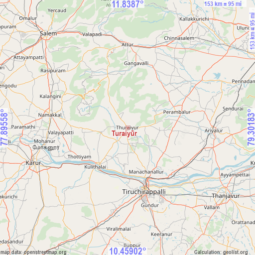
Turaiyūr GPS coordinates[2]
11° 8' 58.848" North, 78° 35' 55.32" East
| Map corner | latitude | longitude |
|---|---|---|
| Upper-left | 11.8387°, | 77.89558° |
| Center: | 11.14968°, | 78.5987° |
| Lower-right: | 10.45902°, | 79.30183° |
| Map W x H: | 153.4×153.4 km | = 95.3×95.3mi |
| max Lat: | 34.9274° ⇑92.6% North |
| Turaiyūr: | 11.14968° |
| min Lat: | ⇓7.4% South 8.09008° |
| min Long | Turaiyūr | max Long |
| 68.82655° | 78.5987° | 96.81° |
| W 55.2%⇐ | ⇒44.8% E |
Elevation
Elevation of Turaiyūr is 146 m = 479 ft, and this is 149.6 m = 491 ft below average elevation for this country.
| Max E: |
3681 m = 12077 ft | 60.4% |
| Avg. | 295.6 m = 970 ft | |
| Turaiyūr | 146 m = 479 ft | |
Min E: |
1 m = 3 ft | 39.6% |
See also: India elevation on elevation.city.
Geographical zone
Turaiyūr is located in North Torrid zone (between Equator and Tropic of Cancer). Distance of Equator is 1239.7 km =770.3 mi to South.| Distance of | km | miles | from Turaiyūr |
|---|---|---|---|
| North Pole | 8767.3 | 5447.7 | to North |
| Arctic Circle | 6161.4 | 3828.5 | to North |
| Tropic Cancer | 1366.2 | 848.9 | to North |
| Equator | 1239.7 | 770.3 | to South |


Nearby cities:
15 places around Turaiyūr: (largest is in red/bold)
• Arumbāvūr
29.4 km =18.3 mi,  29°
29°
• Erumaippatti
33.7 km =20.9 mi,  269°
269°
• Gangavalli
39.2 km =24.4 mi,  8°
8°
• Kulittalai
31.4 km =19.5 mi,  220°
220°
• Kāttupputtūr
44.9 km =27.9 mi,  247°
247°
• Lalgudi
39 km =24.2 mi,  141°
141°
• Mettuppālaiyam
16.4 km =10.2 mi,  277°
277°
• Musiri
27.6 km =17.1 mi, 217°
• Perambalur
32.4 km =20.1 mi,  73°
73°
• Puduppatti
42.2 km =26.2 mi, 270°
• Pullambādi
41.2 km =25.6 mi,  124°
124°
• Tiruchirappalli
38.7 km =24 mi,  163°
163°
• Tāttayyangārpettai
16.6 km =10.3 mi,  260°
260°
• Uppiliyapuram
15.7 km =9.8 mi,  323°
323°
• Vīraganūr
39.2 km =24.4 mi,  22°
22°
Sources, notices
• [Note1] Compared only with cities in India existing in our database
• [Src1] Map data: © OpenStreetMap contributors (CC-BY-SA)
• [Src2] Other city data from geonames.org with taken over terms of usage.
• [Src3] Geographical zone / Annual Mean Temperature by Robert A. Rohde @ Wikipedia
