Puduppatti geodata
Puduppatti (Tamil Nadu) is a populated place; located in India in Asia/Kolkata (GMT+5.5) time zone. With population of 7,570 people, there are 3165 cities with bigger population in this country. Compared to other cities in India, 92.6% of cities are located further ↑North; 51.3% of cities are located further ←West and 58.4% of cities have higher elevation than Puduppatti. Note1


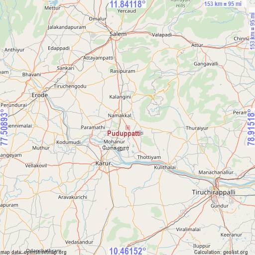
Puduppatti GPS coordinates[2]
11° 9' 7.812" North, 78° 12' 43.38" East
| Map corner | latitude | longitude |
|---|---|---|
| Upper-left | 11.84118°, | 77.50893° |
| Center: | 11.15217°, | 78.21205° |
| Lower-right: | 10.46152°, | 78.91518° |
| Map W x H: | 153.4×153.4 km | = 95.3×95.3mi |
| max Lat: | 34.9274° ⇑92.6% North |
| Puduppatti: | 11.15217° |
| min Lat: | ⇓7.4% South 8.09008° |
| min Long | Puduppatti | max Long |
| 68.82655° | 78.21205° | 96.81° |
| W 51.3%⇐ | ⇒48.7% E |
Elevation
Elevation of Puduppatti is 156 m = 512 ft, and this is 139.6 m = 458 ft below average elevation for this country.
| Max E: |
3681 m = 12077 ft | 58.4% |
| Avg. | 295.6 m = 970 ft | |
| Puduppatti | 156 m = 512 ft | |
Min E: |
1 m = 3 ft | 41.6% |
See also: India elevation on elevation.city.
Geographical zone
Puduppatti is located in North Torrid zone (between Equator and Tropic of Cancer). Distance of Equator is 1240 km =770.5 mi to South.| Distance of | km | miles | from Puduppatti |
|---|---|---|---|
| North Pole | 8767.1 | 5447.6 | to North |
| Arctic Circle | 6161.2 | 3828.4 | to North |
| Tropic Cancer | 1365.9 | 848.7 | to North |
| Equator | 1240 | 770.5 | to South |


Nearby cities:
15 places around Puduppatti: (largest is in red/bold)
• Erumaippatti
8.5 km =5.3 mi,  94°
94°
• Karur
25.9 km =16.1 mi,  213°
213°
• Kodumudi
36.8 km =22.9 mi,  256°
256°
• Kulittalai
32.6 km =20.3 mi,  137°
137°
• Kāttupputtūr
17.6 km =10.9 mi,  177°
177°
• Mettuppālaiyam
26 km =16.2 mi, 86°
• Mohanūr
13 km =8.1 mi,  217°
217°
• Musiri
33.7 km =20.9 mi,  131°
131°
• Nāmagiripettai
34.2 km =21.3 mi,  10°
10°
• Nāmakkal
9.2 km =5.7 mi,  326°
326°
• Rasipuram
34.4 km =21.4 mi,  355°
355°
• Turaiyūr
42.2 km =26.2 mi, 90°
• Tāttayyangārpettai
26.1 km =16.2 mi,  96°
96°
• Uppiliyapuram
35.2 km =21.9 mi,  69°
69°
• Velur
23.5 km =14.6 mi, 258°
Sources, notices
• [Note1] Compared only with cities in India existing in our database
• [Src1] Map data: © OpenStreetMap contributors (CC-BY-SA)
• [Src2] Other city data from geonames.org with taken over terms of usage.
• [Src3] Geographical zone / Annual Mean Temperature by Robert A. Rohde @ Wikipedia
