Gangavalli geodata
Gangavalli (Tamil Nadu) is a populated place; located in India in Asia/Kolkata (GMT+5.5) time zone. With population of 10,905 people, there are 2842 cities with bigger population in this country. Compared to other cities in India, 91.3% of cities are located further ↑North; 55.6% of cities are located further ←West and 51.3% of cities have lower elevation than Gangavalli. Note1


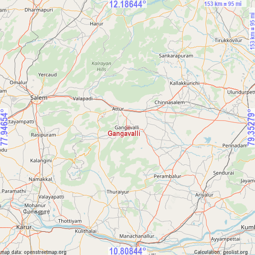
Gangavalli GPS coordinates[2]
11° 29' 53.808" North, 78° 38' 58.776" East
| Map corner | latitude | longitude |
|---|---|---|
| Upper-left | 12.18644°, | 77.94654° |
| Center: | 11.49828°, | 78.64966° |
| Lower-right: | 10.80844°, | 79.35279° |
| Map W x H: | 153.2×153.2 km | = 95.2×95.2mi |
| max Lat: | 34.9274° ⇑91.3% North |
| Gangavalli: | 11.49828° |
| min Lat: | ⇓8.7% South 8.09008° |
| min Long | Gangavalli | max Long |
| 68.82655° | 78.64966° | 96.81° |
| W 55.6%⇐ | ⇒44.4% E |
Elevation
Elevation of Gangavalli is 209 m = 686 ft, and this is 86.6 m = 284 ft below average elevation for this country.
| Max E: |
3681 m = 12077 ft | 48.7% |
| Avg. | 295.6 m = 970 ft | |
| Gangavalli | 209 m = 686 ft | |
Min E: |
1 m = 3 ft | 51.3% |
See also: India elevation on elevation.city.
Geographical zone
Gangavalli is located in North Torrid zone (between Equator and Tropic of Cancer). Distance of Equator is 1278.5 km =794.4 mi to South.| Distance of | km | miles | from Gangavalli |
|---|---|---|---|
| North Pole | 8728.6 | 5423.7 | to North |
| Arctic Circle | 6122.7 | 3804.5 | to North |
| Tropic Cancer | 1327.4 | 824.8 | to North |
| Equator | 1278.5 | 794.4 | to South |


Nearby cities:
15 places around Gangavalli: (largest is in red/bold)
• Alagāpuram
52.1 km =32.4 mi,  34°
34°
• Arumbāvūr
15.7 km =9.8 mi,  146°
146°
• Attur
11.9 km =7.4 mi,  333°
333°
• Belūr
34.6 km =21.5 mi,  312°
312°
• Chinna Salem
28.7 km =17.8 mi,  58°
58°
• Erumaippatti
55.4 km =34.4 mi,  225°
225°
• Kallakkurichchi
43.1 km =26.8 mi,  51°
51°
• Mettuppālaiyam
42.7 km =26.5 mi,  210°
210°
• Nāmagiripettai
41.8 km =26 mi,  263°
263°
• Perambalur
38.9 km =24.2 mi,  139°
139°
• Rasipuram
50.7 km =31.5 mi,  265°
265°
• Turaiyūr
39.2 km =24.4 mi,  188°
188°
• Tāttayyangārpettai
47 km =29.2 mi, 207°
• Uppiliyapuram
30 km =18.6 mi, 209°
• Vīraganūr
9.7 km =6 mi,  104°
104°
Sources, notices
• [Note1] Compared only with cities in India existing in our database
• [Src1] Map data: © OpenStreetMap contributors (CC-BY-SA)
• [Src2] Other city data from geonames.org with taken over terms of usage.
• [Src3] Geographical zone / Annual Mean Temperature by Robert A. Rohde @ Wikipedia
