Tīkri geodata
Tīkri (Uttar Pradesh) is a populated place; located in India in Asia/Kolkata (GMT+5.5) time zone. With population of 13,646 people, there are 2599 cities with bigger population in this country. Compared to other cities in India, 89.9% of cities are located further ↓South; 58.9% of cities are located further →East and 58% of cities have lower elevation than Tīkri. Note1


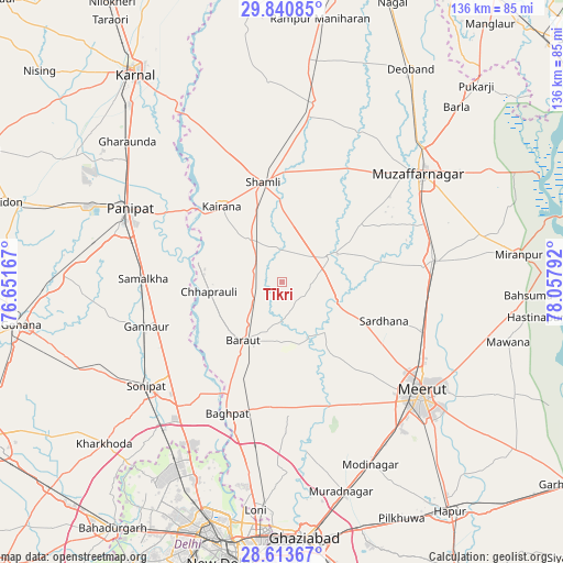
Tīkri GPS coordinates[2]
29° 13' 44.76" North, 77° 21' 17.244" East
| Map corner | latitude | longitude |
|---|---|---|
| Upper-left | 29.84085°, | 76.65167° |
| Center: | 29.2291°, | 77.35479° |
| Lower-right: | 28.61367°, | 78.05792° |
| Map W x H: | 136.4×136.5 km | = 84.8×84.8mi |
| max Lat: | 34.9274° ⇑10.1% North |
| Tīkri: | 29.2291° |
| min Lat: | ⇓89.9% South 8.09008° |
| min Long | Tīkri | max Long |
| 68.82655° | 77.35479° | 96.81° |
| W 41.1%⇐ | ⇒58.9% E |
Elevation
Elevation of Tīkri is 239 m = 784 ft, and this is 56.6 m = 186 ft below average elevation for this country.
| Max E: |
3681 m = 12077 ft | 42% |
| Avg. | 295.6 m = 970 ft | |
| Tīkri | 239 m = 784 ft | |
Min E: |
1 m = 3 ft | 58% |
See also: India elevation on elevation.city.
Geographical zone
Tīkri is located in North temperate zone (between Tropic of Cancer and the Arctic Circle). Distance of this Northern Tropic circle is 644.1 km =400.2 mi to South.| Distance of | km | miles | from Tīkri |
|---|---|---|---|
| North Pole | 6757.1 | 4198.7 | to North |
| Arctic Circle | 4151.2 | 2579.4 | to North |
| Tropic Cancer | 644.1 | 400.2 | to South |
| Equator | 3250 | 2019.5 | to South |


Nearby cities:
15 places around Tīkri: (largest is in red/bold)
• Banat
26.1 km =16.2 mi,  359°
359°
• Baraut
16.7 km =10.4 mi,  212°
212°
• Budhāna
13.4 km =8.3 mi,  60°
60°
• Bāghpat
34.3 km =21.3 mi,  202°
202°
• Chhaprauli
17.6 km =10.9 mi,  263°
263°
• Daurāla
36.3 km =22.6 mi,  110°
110°
• Garhi Pūkhta
35.9 km =22.3 mi,  352°
352°
• Jhinjhāna
34.8 km =21.6 mi,  338°
338°
• Kairāna
23.5 km =14.6 mi,  321°
321°
• Kāndhla
13.1 km =8.1 mi, 321°
• Samālkha
33.2 km =20.6 mi,  271°
271°
• Sardhana
26.9 km =16.7 mi, 110°
• Shāhpur
23.4 km =14.5 mi,  54°
54°
• Shāmli
24.9 km =15.5 mi, 349°
• Sisauli
23.3 km =14.5 mi,  28°
28°
Sources, notices
• [Note1] Compared only with cities in India existing in our database
• [Src1] Map data: © OpenStreetMap contributors (CC-BY-SA)
• [Src2] Other city data from geonames.org with taken over terms of usage.
• [Src3] Geographical zone / Annual Mean Temperature by Robert A. Rohde @ Wikipedia
