Sorbhog geodata
Sorbhog (Assam) is a populated place; located in India in Asia/Kolkata (GMT+5.5) time zone. With population of 7,614 people, there are 3159 cities with bigger population in this country. Compared to other cities in India, 74.5% of cities are located further ↓South; 96.1% of cities are located further ←West and 78.3% of cities have higher elevation than Sorbhog. Note1


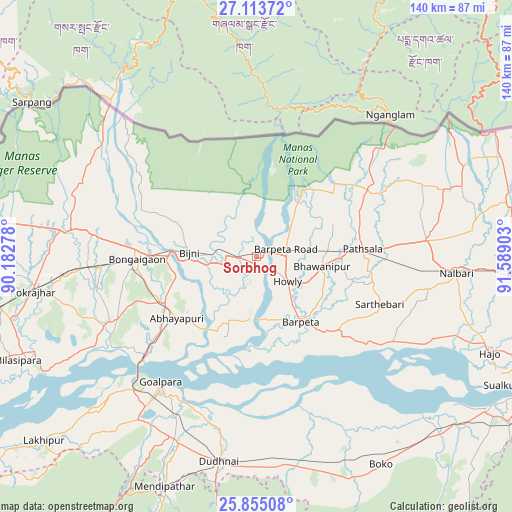
Sorbhog GPS coordinates[2]
26° 29' 10.032" North, 90° 53' 9.24" East
| Map corner | latitude | longitude |
|---|---|---|
| Upper-left | 27.11372°, | 90.18278° |
| Center: | 26.48612°, | 90.8859° |
| Lower-right: | 25.85508°, | 91.58903° |
| Map W x H: | 139.9×139.9 km | = 86.9×86.9mi |
| max Lat: | 34.9274° ⇑25.5% North |
| Sorbhog: | 26.48612° |
| min Lat: | ⇓74.5% South 8.09008° |
| min Long | Sorbhog | max Long |
| 68.82655° | 90.8859° | 96.81° |
| W 96.1%⇐ | ⇒3.9% E |
Elevation
Elevation of Sorbhog is 54 m = 177 ft, and this is 241.6 m = 793 ft below average elevation for this country.
| Max E: |
3681 m = 12077 ft | 78.3% |
| Avg. | 295.6 m = 970 ft | |
| Sorbhog | 54 m = 177 ft | |
Min E: |
1 m = 3 ft | 21.7% |
See also: India elevation on elevation.city.
Geographical zone
Sorbhog is located in North temperate zone (between Tropic of Cancer and the Arctic Circle). Distance of this Northern Tropic circle is 339.1 km =210.7 mi to South.| Distance of | km | miles | from Sorbhog |
|---|---|---|---|
| North Pole | 7062.1 | 4388.2 | to North |
| Arctic Circle | 4456.2 | 2769 | to North |
| Tropic Cancer | 339.1 | 210.7 | to South |
| Equator | 2945 | 1829.9 | to South |


Nearby cities:
15 places around Sorbhog: (largest is in red/bold)
• Abhayāpuri
27 km =16.8 mi,  227°
227°
• Barpeta
21.8 km =13.5 mi,  146°
146°
• Barpeta Road
8.5 km =5.3 mi,  77°
77°
• Bijni
18.2 km =11.3 mi,  273°
273°
• Bilāsipāra
70.8 km =44 mi,  246°
246°
• Bongaigaon
32.6 km =20.3 mi, 268°
• Bāsugaon
46.5 km =28.9 mi, 267°
• Chāpar
49.9 km =31 mi,  241°
241°
• Goālpāra
43 km =26.7 mi,  216°
216°
• Howli
11.8 km =7.3 mi,  127°
127°
• Hājo
69.1 km =42.9 mi,  112°
112°
• Jogīghopa
42.5 km =26.4 mi, 227°
• Kokrajhar
61.8 km =38.4 mi,  261°
261°
• Mushalpur
54.7 km =34 mi, 79°
• Resubelpara
70.4 km =43.7 mi,  203°
203°
Sources, notices
• [Note1] Compared only with cities in India existing in our database
• [Src1] Map data: © OpenStreetMap contributors (CC-BY-SA)
• [Src2] Other city data from geonames.org with taken over terms of usage.
• [Src3] Geographical zone / Annual Mean Temperature by Robert A. Rohde @ Wikipedia
