Barpeta geodata
Barpeta (Assam) is a populated place; located in India in Asia/Kolkata (GMT+5.5) time zone. With population of 48,824 people, there are 906 cities with bigger population in this country. Compared to other cities in India, 73.2% of cities are located further ↓South; 96.2% of cities are located further ←West and 80.2% of cities have higher elevation than Barpeta. Note1


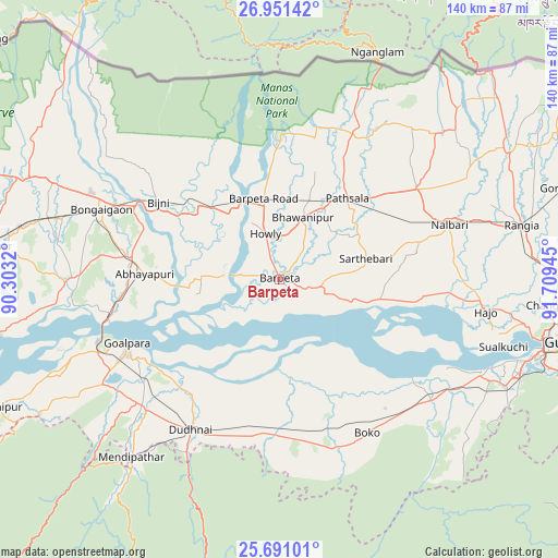
Barpeta GPS coordinates[2]
26° 19' 22.548" North, 91° 0' 22.752" East
| Map corner | latitude | longitude |
|---|---|---|
| Upper-left | 26.95142°, | 90.3032° |
| Center: | 26.32293°, | 91.00632° |
| Lower-right: | 25.69101°, | 91.70945° |
| Map W x H: | 140.1×140.1 km | = 87.1×87.1mi |
| max Lat: | 34.9274° ⇑26.8% North |
| Barpeta: | 26.32293° |
| min Lat: | ⇓73.2% South 8.09008° |
| min Long | Barpeta | max Long |
| 68.82655° | 91.00632° | 96.81° |
| W 96.2%⇐ | ⇒3.8% E |
Elevation
Elevation of Barpeta is 47 m = 154 ft, and this is 248.6 m = 816 ft below average elevation for this country.
| Max E: |
3681 m = 12077 ft | 80.2% |
| Avg. | 295.6 m = 970 ft | |
| Barpeta | 47 m = 154 ft | |
Min E: |
1 m = 3 ft | 19.8% |
See also: Barpeta elevation on elevation.city.
Geographical zone
Barpeta is located in North temperate zone (between Tropic of Cancer and the Arctic Circle). Distance of this Northern Tropic circle is 320.9 km =199.4 mi to South.| Distance of | km | miles | from Barpeta |
|---|---|---|---|
| North Pole | 7080.2 | 4399.4 | to North |
| Arctic Circle | 4474.3 | 2780.2 | to North |
| Tropic Cancer | 320.9 | 199.4 | to South |
| Equator | 2926.8 | 1818.6 | to South |


Nearby cities:
15 places around Barpeta: (largest is in red/bold)
• Abhayāpuri
32 km =19.9 mi,  269°
269°
• Barpeta Road
20.3 km =12.6 mi,  349°
349°
• Bijni
35.8 km =22.2 mi,  302°
302°
• Bongaigaon
47.8 km =29.7 mi,  291°
291°
• Bāsugaon
60.6 km =37.7 mi, 285°
• Chāpar
56.2 km =34.9 mi,  264°
264°
• Goālpāra
41.2 km =25.6 mi,  246°
246°
• Howli
11.4 km =7.1 mi, 346°
• Hājo
52.5 km =32.6 mi,  99°
99°
• Jogīghopa
44.6 km =27.7 mi, 256°
• Mushalpur
50.6 km =31.4 mi,  55°
55°
• Palāsbāri
57.6 km =35.8 mi,  112°
112°
• Resubelpara
61.3 km =38.1 mi,  220°
220°
• Soalkuchi
58.9 km =36.6 mi, 106°
• Sorbhog
21.8 km =13.5 mi,  326°
326°
Sources, notices
• [Note1] Compared only with cities in India existing in our database
• [Src1] Map data: © OpenStreetMap contributors (CC-BY-SA)
• [Src2] Other city data from geonames.org with taken over terms of usage.
• [Src3] Geographical zone / Annual Mean Temperature by Robert A. Rohde @ Wikipedia
