Allahābād geodata
Allahābād (Uttar Pradesh) is a populated place; located in India in Asia/Kolkata (GMT+5.5) time zone. With population of 1,073,438 people, there are 35 cities with bigger population in this country. Compared to other cities in India, 66.4% of cities are located further ↓South; 76% of cities are located further ←West and 68.7% of cities have higher elevation than Allahābād. Note1


Allahābād GPS coordinates[2]
25° 26' 41.208" North, 81° 50' 35.592" East
| Map corner | latitude | longitude |
|---|---|---|
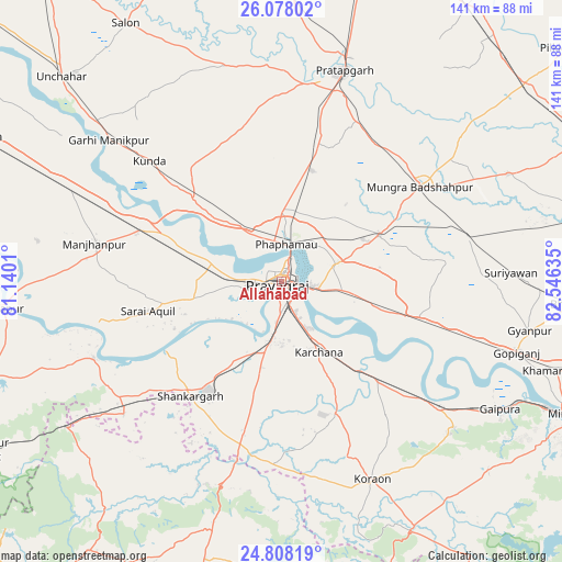
| Upper-left | 26.07802°, | 81.1401° |
| Center: | 25.44478°, | 81.84322° |
| Lower-right: | 24.80819°, | 82.54635° |
| Map W x H: | 141.2×141.2 km | = 87.7×87.7mi |
| max Lat: | 34.9274° ⇑33.6% North |
| Allahābād: | 25.44478° |
| min Lat: | ⇓66.4% South 8.09008° |
| min Long | Allahābād | max Long |
| 68.82655° | 81.84322° | 96.81° |
| W 76%⇐ | ⇒24% E |
Elevation
Elevation of Allahābād is 99 m = 325 ft, and this is 196.6 m = 645 ft below average elevation for this country.
| Max E: |
3681 m = 12077 ft | 68.7% |
| Avg. | 295.6 m = 970 ft | |
| Allahābād | 99 m = 325 ft | |
Min E: |
1 m = 3 ft | 31.3% |
See also: Allahābād elevation on elevation.city.
Geographical zone
Allahābād is located in North temperate zone (between Tropic of Cancer and the Arctic Circle). Distance of this Northern Tropic circle is 223.3 km =138.8 mi to South.| Distance of | km | miles | from Allahābād |
|---|---|---|---|
| North Pole | 7177.9 | 4460.1 | to North |
| Arctic Circle | 4572 | 2840.9 | to North |
| Tropic Cancer | 223.3 | 138.8 | to South |
| Equator | 2829.2 | 1758 | to South |


Nearby cities:
15 places around Allahābād: (largest is in red/bold)
• Bela
55.1 km =34.2 mi,  16°
16°
• Bharwāri
37.6 km =23.4 mi,  290°
290°
• Chail
21.3 km =13.2 mi,  264°
264°
• Handiā
35.6 km =22.1 mi,  104°
104°
• Jhūsi
6.3 km =3.9 mi, 97°
• Karārī
41.8 km =26 mi,  271°
271°
• Kunda
44.8 km =27.8 mi,  312°
312°
• Manjhanpur
47.9 km =29.8 mi,  281°
281°
• Mau Aimma
29 km =18 mi, 16°
• Phulpur
27.3 km =17 mi,  64°
64°
• Pratāpgarh
51 km =31.7 mi,  11°
11°
• Sarāi Ākil
34.2 km =21.3 mi, 257°
• Shankargarh
37 km =23 mi,  217°
217°
• Sirsā
32.1 km =19.9 mi,  128°
128°
• Sohāgi
53.6 km =33.3 mi,  196°
196°
In other languages:
- In Spanish: Allahabad
- In France: Allāhābād
- In German: Allahabad
- In Russian: Аллахабад
- In Chinese: 安拉阿巴德
Sources, notices
• [Note1] Compared only with cities in India existing in our database
• [Src1] Map data: © OpenStreetMap contributors (CC-BY-SA)
• [Src2] Other city data from geonames.org with taken over terms of usage.
• [Src3] Geographical zone / Annual Mean Temperature by Robert A. Rohde @ Wikipedia
