Rāzampeta geodata
Rāzampeta (Andhra Pradesh) is a populated place; located in India in Asia/Kolkata (GMT+5.5) time zone. With population of 31,079 people, there are 1393 cities with bigger population in this country. Compared to other cities in India, 83% of cities are located further ↑North; 60.5% of cities are located further ←West and 61.8% of cities have higher elevation than Rāzampeta. Note1


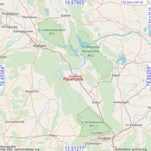
Rāzampeta GPS coordinates[2]
14° 11' 43.584" North, 79° 9' 32.256" East
| Map corner | latitude | longitude |
|---|---|---|
| Upper-left | 14.87605°, | 78.45584° |
| Center: | 14.19544°, | 79.15896° |
| Lower-right: | 13.51277°, | 79.86209° |
| Map W x H: | 151.6×151.6 km | = 94.2×94.2mi |
| max Lat: | 34.9274° ⇑83% North |
| Rāzampeta: | 14.19544° |
| min Lat: | ⇓17% South 8.09008° |
| min Long | Rāzampeta | max Long |
| 68.82655° | 79.15896° | 96.81° |
| W 60.5%⇐ | ⇒39.5% E |
Elevation
Elevation of Rāzampeta is 139 m = 456 ft, and this is 156.6 m = 514 ft below average elevation for this country.
| Max E: |
3681 m = 12077 ft | 61.8% |
| Avg. | 295.6 m = 970 ft | |
| Rāzampeta | 139 m = 456 ft | |
Min E: |
1 m = 3 ft | 38.2% |
See also: India elevation on elevation.city.
Geographical zone
Rāzampeta is located in North Torrid zone (between Equator and Tropic of Cancer). Distance of this Northern Tropic circle is 1027.5 km =638.5 mi to North.| Distance of | km | miles | from Rāzampeta |
|---|---|---|---|
| North Pole | 8428.7 | 5237.3 | to North |
| Arctic Circle | 5822.8 | 3618.1 | to North |
| Tropic Cancer | 1027.5 | 638.5 | to North |
| Equator | 1578.4 | 980.8 | to South |


Nearby cities:
15 places around Rāzampeta: (largest is in red/bold)
• Akkarampalle
66.9 km =41.6 mi,  155°
155°
• Badvel
62 km =38.5 mi,  350°
350°
• Chinnachowk
46.7 km =29 mi,  311°
311°
• Cuddapah
48 km =29.8 mi, 311°
• Erraguntla
82.9 km =51.5 mi, 306°
• Gūdūr
74.9 km =46.5 mi,  93°
93°
• Kāmalāpuram
69.2 km =43 mi, 310°
• Narasingāpuram
67.5 km =41.9 mi,  165°
165°
• Nāgireddipalli
10.4 km =6.5 mi,  323°
323°
• Renigunta
71.5 km =44.4 mi,  147°
147°
• Rāyachoti
46.6 km =29 mi,  250°
250°
• Tirumala
60.6 km =37.7 mi, 160°
• Tirupati
68.3 km =42.4 mi, 155°
• Vadlapūdi
70.7 km =43.9 mi,  79°
79°
• Venkatagiri
52.4 km =32.6 mi,  119°
119°
Sources, notices
• [Note1] Compared only with cities in India existing in our database
• [Src1] Map data: © OpenStreetMap contributors (CC-BY-SA)
• [Src2] Other city data from geonames.org with taken over terms of usage.
• [Src3] Geographical zone / Annual Mean Temperature by Robert A. Rohde @ Wikipedia
