Purushottampur geodata
Purushottampur (Odisha) is a populated place; located in India in Asia/Kolkata (GMT+5.5) time zone. With population of 14,707 people, there are 2494 cities with bigger population in this country. Compared to other cities in India, 66.8% of cities are located further ↑North; 84% of cities are located further ←West and 87.6% of cities have higher elevation than Purushottampur. Note1


Purushottampur GPS coordinates[2]
19° 31' 12.864" North, 84° 53' 6.504" East
| Map corner | latitude | longitude |
|---|---|---|
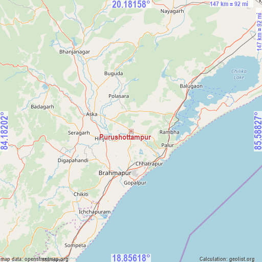
| Upper-left | 20.18158°, | 84.18202° |
| Center: | 19.52024°, | 84.88514° |
| Lower-right: | 18.85618°, | 85.58827° |
| Map W x H: | 147.4×147.4 km | = 91.6×91.6mi |
| max Lat: | 34.9274° ⇑66.8% North |
| Purushottampur: | 19.52024° |
| min Lat: | ⇓33.2% South 8.09008° |
| min Long | Purushottampur | max Long |
| 68.82655° | 84.88514° | 96.81° |
| W 84%⇐ | ⇒16% E |
Elevation
Elevation of Purushottampur is 23 m = 75 ft, and this is 272.6 m = 894 ft below average elevation for this country.
| Max E: |
3681 m = 12077 ft | 87.6% |
| Avg. | 295.6 m = 970 ft | |
| Purushottampur | 23 m = 75 ft | |
Min E: |
1 m = 3 ft | 12.4% |
See also: India elevation on elevation.city.
Geographical zone
Purushottampur is located in North Torrid zone (between Equator and Tropic of Cancer). Distance of this Northern Tropic circle is 435.5 km =270.6 mi to North.| Distance of | km | miles | from Purushottampur |
|---|---|---|---|
| North Pole | 7836.6 | 4869.4 | to North |
| Arctic Circle | 5230.7 | 3250.2 | to North |
| Tropic Cancer | 435.5 | 270.6 | to North |
| Equator | 2170.4 | 1348.6 | to South |


Nearby cities:
15 places around Purushottampur: (largest is in red/bold)
• Belaguntha
47.9 km =29.8 mi,  327°
327°
• Brahmapur
25.1 km =15.6 mi,  202°
202°
• Buguda
33.5 km =20.8 mi,  342°
342°
• Bānapur
41.5 km =25.8 mi,  46°
46°
• Chatrapur
21 km =13 mi,  150°
150°
• Chikitigarh
45.3 km =28.1 mi,  218°
218°
• Digapahandi
36.7 km =22.8 mi,  243°
243°
• Ganjām
22.8 km =14.2 mi,  130°
130°
• Gopālpur
29.2 km =18.1 mi,  175°
175°
• Hinjilikatu
15.3 km =9.5 mi,  253°
253°
• Khallikot
23.3 km =14.5 mi,  64°
64°
• Kodala
12.9 km =8 mi,  26°
26°
• Polasara
20.7 km =12.9 mi, 338°
• Rambha
22.5 km =14 mi,  91°
91°
• Āsika
25.7 km =16 mi,  293°
293°
Sources, notices
• [Note1] Compared only with cities in India existing in our database
• [Src1] Map data: © OpenStreetMap contributors (CC-BY-SA)
• [Src2] Other city data from geonames.org with taken over terms of usage.
• [Src3] Geographical zone / Annual Mean Temperature by Robert A. Rohde @ Wikipedia
