Kodala geodata
Kodala (Odisha) is a populated place; located in India in Asia/Kolkata (GMT+5.5) time zone. With population of 13,187 people, there are 2637 cities with bigger population in this country. Compared to other cities in India, 66.6% of cities are located further ↑North; 84.1% of cities are located further ←West and 82.6% of cities have higher elevation than Kodala. Note1


Kodala GPS coordinates[2]
19° 37' 27.3" North, 84° 56' 26.7" East
| Map corner | latitude | longitude |
|---|---|---|
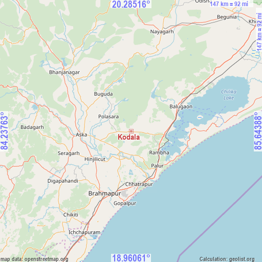
| Upper-left | 20.28516°, | 84.23763° |
| Center: | 19.62425°, | 84.94075° |
| Lower-right: | 18.96061°, | 85.64388° |
| Map W x H: | 147.3×147.3 km | = 91.5×91.5mi |
| max Lat: | 34.9274° ⇑66.6% North |
| Kodala: | 19.62425° |
| min Lat: | ⇓33.4% South 8.09008° |
| min Long | Kodala | max Long |
| 68.82655° | 84.94075° | 96.81° |
| W 84.1%⇐ | ⇒15.9% E |
Elevation
Elevation of Kodala is 38 m = 125 ft, and this is 257.6 m = 845 ft below average elevation for this country.
| Max E: |
3681 m = 12077 ft | 82.6% |
| Avg. | 295.6 m = 970 ft | |
| Kodala | 38 m = 125 ft | |
Min E: |
1 m = 3 ft | 17.4% |
See also: India elevation on elevation.city.
Geographical zone
Kodala is located in North Torrid zone (between Equator and Tropic of Cancer). Distance of this Northern Tropic circle is 423.9 km =263.4 mi to North.| Distance of | km | miles | from Kodala |
|---|---|---|---|
| North Pole | 7825 | 4862.2 | to North |
| Arctic Circle | 5219.2 | 3243.1 | to North |
| Tropic Cancer | 423.9 | 263.4 | to North |
| Equator | 2182 | 1355.8 | to South |


Nearby cities:
15 places around Kodala: (largest is in red/bold)
• Belaguntha
42.8 km =26.6 mi,  312°
312°
• Bhanjanagar
50.4 km =31.3 mi, 311°
• Brahmapur
38.1 km =23.7 mi,  204°
204°
• Buguda
25.8 km =16 mi,  322°
322°
• Bānapur
29.6 km =18.4 mi,  54°
54°
• Chatrapur
30.2 km =18.8 mi,  171°
171°
• Digapahandi
47.7 km =29.6 mi,  234°
234°
• Ganjām
28.8 km =17.9 mi,  156°
156°
• Gopālpur
40.8 km =25.4 mi,  185°
185°
• Hinjilikatu
25.9 km =16.1 mi, 232°
• Khallikot
15.3 km =9.5 mi,  96°
96°
• Polasara
15.4 km =9.6 mi,  300°
300°
• Purushottampur
12.9 km =8 mi,  206°
206°
• Rambha
20.5 km =12.7 mi,  125°
125°
• Āsika
29.4 km =18.3 mi,  267°
267°
Sources, notices
• [Note1] Compared only with cities in India existing in our database
• [Src1] Map data: © OpenStreetMap contributors (CC-BY-SA)
• [Src2] Other city data from geonames.org with taken over terms of usage.
• [Src3] Geographical zone / Annual Mean Temperature by Robert A. Rohde @ Wikipedia
