Bānapur geodata
Bānapur (Odisha) is a populated place; located in India in Asia/Kolkata (GMT+5.5) time zone. With population of 17,499 people, there are 2239 cities with bigger population in this country. Compared to other cities in India, 66% of cities are located further ↑North; 84.7% of cities are located further ←West and 87.6% of cities have higher elevation than Bānapur. Note1


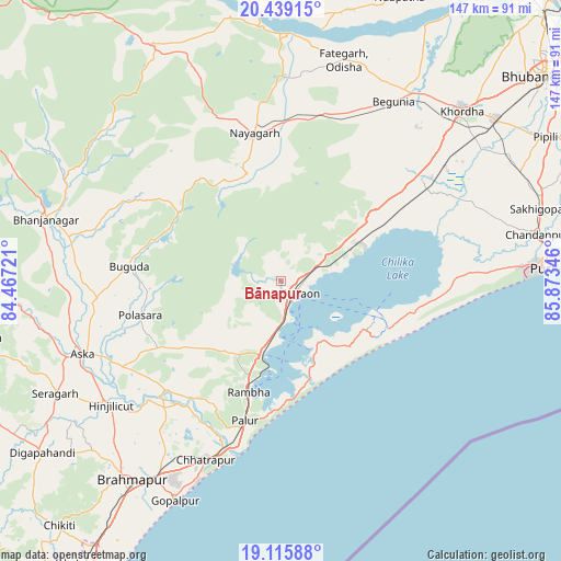
Bānapur GPS coordinates[2]
19° 46' 44.004" North, 85° 10' 13.188" East
| Map corner | latitude | longitude |
|---|---|---|
| Upper-left | 20.43915°, | 84.46721° |
| Center: | 19.77889°, | 85.17033° |
| Lower-right: | 19.11588°, | 85.87346° |
| Map W x H: | 147.1×147.1 km | = 91.4×91.4mi |
| max Lat: | 34.9274° ⇑66% North |
| Bānapur: | 19.77889° |
| min Lat: | ⇓34% South 8.09008° |
| min Long | Bānapur | max Long |
| 68.82655° | 85.17033° | 96.81° |
| W 84.7%⇐ | ⇒15.3% E |
Elevation
Elevation of Bānapur is 23 m = 75 ft, and this is 272.6 m = 894 ft below average elevation for this country.
| Max E: |
3681 m = 12077 ft | 87.6% |
| Avg. | 295.6 m = 970 ft | |
| Bānapur | 23 m = 75 ft | |
Min E: |
1 m = 3 ft | 12.4% |
See also: India elevation on elevation.city.
Geographical zone
Bānapur is located in North Torrid zone (between Equator and Tropic of Cancer). Distance of this Northern Tropic circle is 406.7 km =252.7 mi to North.| Distance of | km | miles | from Bānapur |
|---|---|---|---|
| North Pole | 7807.9 | 4851.6 | to North |
| Arctic Circle | 5202 | 3232.4 | to North |
| Tropic Cancer | 406.7 | 252.7 | to North |
| Equator | 2199.2 | 1366.5 | to South |


Nearby cities:
15 places around Bānapur: (largest is in red/bold)
• Belaguntha
56.9 km =35.4 mi,  281°
281°
• Bhanjanagar
63.7 km =39.6 mi,  285°
285°
• Buguda
39.8 km =24.7 mi,  274°
274°
• Bālugaon
44.8 km =27.8 mi,  352°
352°
• Chatrapur
51 km =31.7 mi,  202°
202°
• Ganjām
45.3 km =28.1 mi, 196°
• Gopālpur
64.2 km =39.9 mi,  205°
205°
• Hinjilikatu
55.5 km =34.5 mi,  233°
233°
• Khallikot
20.8 km =12.9 mi, 205°
• Kodala
29.6 km =18.4 mi, 234°
• Nayāgarh
39.7 km =24.7 mi, 348°
• Polasara
38.5 km =23.9 mi,  255°
255°
• Purushottampur
41.5 km =25.8 mi, 226°
• Rambha
30.1 km =18.7 mi,  194°
194°
• Āsika
56.6 km =35.2 mi,  250°
250°
Sources, notices
• [Note1] Compared only with cities in India existing in our database
• [Src1] Map data: © OpenStreetMap contributors (CC-BY-SA)
• [Src2] Other city data from geonames.org with taken over terms of usage.
• [Src3] Geographical zone / Annual Mean Temperature by Robert A. Rohde @ Wikipedia
