Nāmagiripettai geodata
Nāmagiripettai (Tamil Nadu) is a populated place; located in India in Asia/Kolkata (GMT+5.5) time zone. With population of 22,098 people, there are 1900 cities with bigger population in this country. Compared to other cities in India, 91.5% of cities are located further ↑North; 52% of cities are located further ←West and 61.5% of cities have lower elevation than Nāmagiripettai. Note1


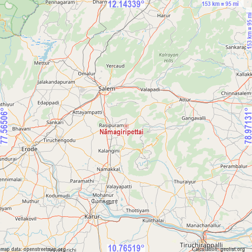
Nāmagiripettai GPS coordinates[2]
11° 27' 18.468" North, 78° 16' 5.448" East
| Map corner | latitude | longitude |
|---|---|---|
| Upper-left | 12.14339°, | 77.56506° |
| Center: | 11.45513°, | 78.26818° |
| Lower-right: | 10.76519°, | 78.97131° |
| Map W x H: | 153.2×153.2 km | = 95.2×95.2mi |
| max Lat: | 34.9274° ⇑91.5% North |
| Nāmagiripettai: | 11.45513° |
| min Lat: | ⇓8.5% South 8.09008° |
| min Long | Nāmagiripettai | max Long |
| 68.82655° | 78.26818° | 96.81° |
| W 52%⇐ | ⇒48% E |
Elevation
Elevation of Nāmagiripettai is 262 m = 860 ft, and this is 33.6 m = 110 ft below average elevation for this country.
| Max E: |
3681 m = 12077 ft | 38.5% |
| Avg. | 295.6 m = 970 ft | |
| Nāmagiripettai | 262 m = 860 ft | |
Min E: |
1 m = 3 ft | 61.5% |
See also: India elevation on elevation.city.
Geographical zone
Nāmagiripettai is located in North Torrid zone (between Equator and Tropic of Cancer). Distance of Equator is 1273.7 km =791.4 mi to South.| Distance of | km | miles | from Nāmagiripettai |
|---|---|---|---|
| North Pole | 8733.4 | 5426.7 | to North |
| Arctic Circle | 6127.5 | 3807.5 | to North |
| Tropic Cancer | 1332.2 | 827.8 | to North |
| Equator | 1273.7 | 791.4 | to South |


Nearby cities:
15 places around Nāmagiripettai: (largest is in red/bold)
• Attur
39.5 km =24.5 mi,  66°
66°
• Belūr
32.3 km =20.1 mi,  29°
29°
• Erumaippatti
34.4 km =21.4 mi,  176°
176°
• Ilampillai
33.1 km =20.6 mi,  300°
300°
• Mallasamudram
26.2 km =16.3 mi,  279°
279°
• Mettuppālaiyam
37.5 km =23.3 mi,  148°
148°
• Māllūr
17.1 km =10.6 mi,  305°
305°
• Nāmakkal
28.3 km =17.6 mi,  203°
203°
• Omalur
40 km =24.9 mi,  322°
322°
• Puduppatti
34.2 km =21.3 mi,  190°
190°
• Rasipuram
8.9 km =5.5 mi,  273°
273°
• Salem
25.3 km =15.7 mi,  330°
330°
• Tiruchengode
41.6 km =25.8 mi,  258°
258°
• Uppiliyapuram
34.2 km =21.3 mi,  128°
128°
• Āttayyāmpatti
24.9 km =15.5 mi,  290°
290°
Sources, notices
• [Note1] Compared only with cities in India existing in our database
• [Src1] Map data: © OpenStreetMap contributors (CC-BY-SA)
• [Src2] Other city data from geonames.org with taken over terms of usage.
• [Src3] Geographical zone / Annual Mean Temperature by Robert A. Rohde @ Wikipedia
