Mysore geodata
Mysore (Karnataka) is a seat of a second-order administrative division; located in India in Asia/Kolkata (GMT+5.5) time zone. With population of 868,313 people, there are 51 cities with bigger population in this country. Compared to other cities in India, 89.1% of cities are located further ↑North; 66.8% of cities are located further →East and 93.2% of cities have lower elevation than Mysore. Note1


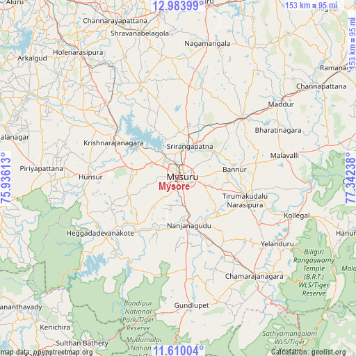
Mysore GPS coordinates[2]
12° 17' 52.476" North, 76° 38' 21.3" East
| Map corner | latitude | longitude |
|---|---|---|
| Upper-left | 12.98399°, | 75.93613° |
| Center: | 12.29791°, | 76.63925° |
| Lower-right: | 11.61004°, | 77.34238° |
| Map W x H: | 152.8×152.8 km | = 94.9×94.9mi |
| max Lat: | 34.9274° ⇑89.1% North |
| Mysore: | 12.29791° |
| min Lat: | ⇓10.9% South 8.09008° |
| min Long | Mysore | max Long |
| 68.82655° | 76.63925° | 96.81° |
| W 33.2%⇐ | ⇒66.8% E |
Elevation
Elevation of Mysore is 757 m = 2484 ft, and this is 461.4 m = 1514 ft above average elevation for this country.
| Max E: |
3681 m = 12077 ft | 6.8% |
| Mysore | 757 m 2484 ft | |
| Avg. | 295.6 m = 970 ft | |
Min E: |
1 m = 3 ft | 93.2% |
See also: Mysore elevation on elevation.city.
Geographical zone
Mysore is located in North Torrid zone (between Equator and Tropic of Cancer). Distance of this Northern Tropic circle is 1238.5 km =769.6 mi to North.| Distance of | km | miles | from Mysore |
|---|---|---|---|
| North Pole | 8639.7 | 5368.5 | to North |
| Arctic Circle | 6033.8 | 3749.2 | to North |
| Tropic Cancer | 1238.5 | 769.6 | to North |
| Equator | 1367.4 | 849.7 | to South |


Nearby cities:
15 places around Mysore: (largest is in red/bold)
• Bannūr
24.5 km =15.2 mi,  80°
80°
• Chamrajnagar
52.9 km =32.9 mi,  141°
141°
• French Rocks
22.9 km =14.2 mi,  9°
9°
• Heggadadevankote
41 km =25.5 mi,  235°
235°
• Hunsūr
37.6 km =23.4 mi,  270°
270°
• Kollegāl
53.6 km =33.3 mi,  107°
107°
• Krishnarājpet
44.1 km =27.4 mi,  338°
338°
• Malavalli
46.8 km =29.1 mi, 77°
• Mandya
37.5 km =23.3 mi,  48°
48°
• Melukote
40.6 km =25.2 mi,  1°
1°
• Nanjangūd
20.6 km =12.8 mi,  166°
166°
• Sargūr
42.4 km =26.3 mi,  218°
218°
• Shrīrangapattana
14.7 km =9.1 mi,  19°
19°
• Tirumakūdal Narsipur
30.1 km =18.7 mi, 108°
• Yelandūr
50.9 km =31.6 mi,  123°
123°
Sources, notices
• [Note1] Compared only with cities in India existing in our database
• [Src1] Map data: © OpenStreetMap contributors (CC-BY-SA)
• [Src2] Other city data from geonames.org with taken over terms of usage.
• [Src3] Geographical zone / Annual Mean Temperature by Robert A. Rohde @ Wikipedia
