Kiri Buru geodata
Kiri Buru (Odisha) is a populated place; located in India in Asia/Kolkata (GMT+5.5) time zone. With population of 9,719 people, there are 2975 cities with bigger population in this country. Compared to other cities in India, 56.2% of cities are located further ↑North; 85.2% of cities are located further ←West and 80.4% of cities have lower elevation than Kiri Buru. Note1


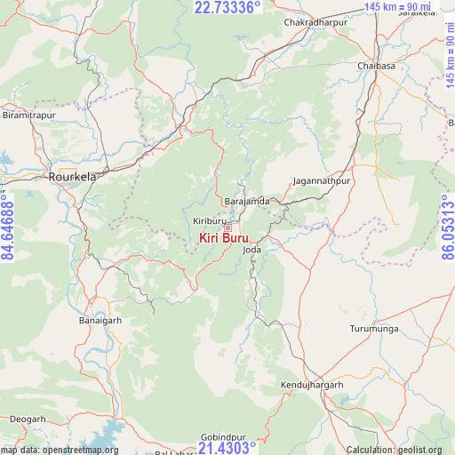
Kiri Buru GPS coordinates[2]
22° 4' 59.988" North, 85° 21' 0" East
| Map corner | latitude | longitude |
|---|---|---|
| Upper-left | 22.73336°, | 84.64688° |
| Center: | 22.08333°, | 85.35° |
| Lower-right: | 21.4303°, | 86.05313° |
| Map W x H: | 144.9×144.9 km | = 90×90mi |
| max Lat: | 34.9274° ⇑56.2% North |
| Kiri Buru: | 22.08333° |
| min Lat: | ⇓43.8% South 8.09008° |
| min Long | Kiri Buru | max Long |
| 68.82655° | 85.35° | 96.81° |
| W 85.2%⇐ | ⇒14.8% E |
Elevation
Elevation of Kiri Buru is 466 m = 1529 ft, and this is 170.4 m = 559 ft above average elevation for this country.
| Max E: |
3681 m = 12077 ft | 19.6% |
| Kiri Buru | 466 m 1529 ft | |
| Avg. | 295.6 m = 970 ft | |
Min E: |
1 m = 3 ft | 80.4% |
See also: India elevation on elevation.city.
Geographical zone
Kiri Buru is located in North Torrid zone (between Equator and Tropic of Cancer). Distance of this Northern Tropic circle is 150.5 km =93.5 mi to North.| Distance of | km | miles | from Kiri Buru |
|---|---|---|---|
| North Pole | 7551.6 | 4692.3 | to North |
| Arctic Circle | 4945.7 | 3073.1 | to North |
| Tropic Cancer | 150.5 | 93.5 | to North |
| Equator | 2455.4 | 1525.7 | to South |


Nearby cities:
15 places around Kiri Buru: (largest is in red/bold)
• Bada Barabīl
4.9 km =3 mi,  50°
50°
• Barbil
3.5 km =2.2 mi, 53°
• Birmitrapur
69.6 km =43.2 mi,  300°
300°
• Bolānīkhodān
3.6 km =2.2 mi,  337°
337°
• Bānposh
58.5 km =36.4 mi,  288°
288°
• Chakradharpur
71.9 km =44.7 mi,  23°
23°
• Chiria
26.4 km =16.4 mi, 343°
• Chāmpua
32.5 km =20.2 mi,  93°
93°
• Chāībāsa
69.7 km =43.3 mi,  41°
41°
• Gua
15 km =9.3 mi, 15°
• Jagannāthpur
33.5 km =20.8 mi,  62°
62°
• Kuchaiburi
87.2 km =54.2 mi,  76°
76°
• Manoharpur
36.2 km =22.5 mi,  333°
333°
• Noāmundi
18.1 km =11.2 mi, 61°
• Raurkela
52.5 km =32.6 mi, 287°
Sources, notices
• [Note1] Compared only with cities in India existing in our database
• [Src1] Map data: © OpenStreetMap contributors (CC-BY-SA)
• [Src2] Other city data from geonames.org with taken over terms of usage.
• [Src3] Geographical zone / Annual Mean Temperature by Robert A. Rohde @ Wikipedia
