Elumalai geodata
Elumalai (Tamil Nadu) is a populated place; located in India in Asia/Kolkata (GMT+5.5) time zone. With population of 14,456 people, there are 2514 cities with bigger population in this country. Compared to other cities in India, 96.9% of cities are located further ↑North; 55.1% of cities are located further →East and 52.3% of cities have lower elevation than Elumalai. Note1


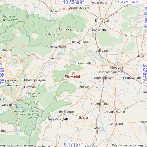
Elumalai GPS coordinates[2]
9° 51' 54.036" North, 77° 41' 57.228" East
| Map corner | latitude | longitude |
|---|---|---|
| Upper-left | 10.55699°, | 76.99611° |
| Center: | 9.86501°, | 77.69923° |
| Lower-right: | 9.17157°, | 78.40236° |
| Map W x H: | 154×154 km | = 95.7×95.7mi |
| max Lat: | 34.9274° ⇑96.9% North |
| Elumalai: | 9.86501° |
| min Lat: | ⇓3.1% South 8.09008° |
| min Long | Elumalai | max Long |
| 68.82655° | 77.69923° | 96.81° |
| W 44.9%⇐ | ⇒55.1% E |
Elevation
Elevation of Elumalai is 214 m = 702 ft, and this is 81.6 m = 268 ft below average elevation for this country.
| Max E: |
3681 m = 12077 ft | 47.7% |
| Avg. | 295.6 m = 970 ft | |
| Elumalai | 214 m = 702 ft | |
Min E: |
1 m = 3 ft | 52.3% |
See also: India elevation on elevation.city.
Geographical zone
Elumalai is located in North Torrid zone (between Equator and Tropic of Cancer). Distance of Equator is 1096.9 km =681.6 mi to South.| Distance of | km | miles | from Elumalai |
|---|---|---|---|
| North Pole | 8910.2 | 5536.5 | to North |
| Arctic Circle | 6304.3 | 3917.3 | to North |
| Tropic Cancer | 1509 | 937.6 | to North |
| Equator | 1096.9 | 681.6 | to South |


Nearby cities:
15 places around Elumalai: (largest is in red/bold)
• Bodināyakkanūr
41.6 km =25.8 mi,  293°
293°
• Chinnamanūr
35 km =21.7 mi,  265°
265°
• Devadānappatti
31.9 km =19.8 mi,  349°
349°
• Kallupatti
24.7 km =15.3 mi,  131°
131°
• Nilakottai
37.2 km =23.1 mi,  26°
26°
• Peraiyur
17.4 km =10.8 mi,  145°
145°
• Periyakulam
33.3 km =20.7 mi,  329°
329°
• Srivilliputhur
39.8 km =24.7 mi,  190°
190°
• Teni
29.2 km =18.1 mi,  303°
303°
• Tirupparangunram
41 km =25.5 mi,  87°
87°
• Usilampatti
15 km =9.3 mi,  39°
39°
• Uttamapālaiyam
41.3 km =25.7 mi,  261°
261°
• Vattalkundu
33.5 km =20.8 mi,  11°
11°
• Vādippatti
37.7 km =23.4 mi,  49°
49°
• Āndippatti
17.1 km =10.6 mi, 329°
Sources, notices
• [Note1] Compared only with cities in India existing in our database
• [Src1] Map data: © OpenStreetMap contributors (CC-BY-SA)
• [Src2] Other city data from geonames.org with taken over terms of usage.
• [Src3] Geographical zone / Annual Mean Temperature by Robert A. Rohde @ Wikipedia
