Chākuliā geodata
Chākuliā (Jharkhand) is a populated place; located in India in Asia/Kolkata (GMT+5.5) time zone. With population of 14,952 people, there are 2468 cities with bigger population in this country. Compared to other cities in India, 53.2% of cities are located further ↑North; 88.8% of cities are located further ←West and 64.7% of cities have higher elevation than Chākuliā. Note1


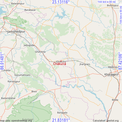
Chākuliā GPS coordinates[2]
22° 28' 58.836" North, 86° 43' 4.548" East
| Map corner | latitude | longitude |
|---|---|---|
| Upper-left | 23.13116°, | 86.01481° |
| Center: | 22.48301°, | 86.71793° |
| Lower-right: | 21.83181°, | 87.42106° |
| Map W x H: | 144.5×144.5 km | = 89.8×89.8mi |
| max Lat: | 34.9274° ⇑53.2% North |
| Chākuliā: | 22.48301° |
| min Lat: | ⇓46.8% South 8.09008° |
| min Long | Chākuliā | max Long |
| 68.82655° | 86.71793° | 96.81° |
| W 88.8%⇐ | ⇒11.2% E |
Elevation
Elevation of Chākuliā is 122 m = 400 ft, and this is 173.6 m = 570 ft below average elevation for this country.
| Max E: |
3681 m = 12077 ft | 64.7% |
| Avg. | 295.6 m = 970 ft | |
| Chākuliā | 122 m = 400 ft | |
Min E: |
1 m = 3 ft | 35.3% |
See also: India elevation on elevation.city.
Geographical zone
Chākuliā is located in North Torrid zone (between Equator and Tropic of Cancer). Distance of this Northern Tropic circle is 106 km =65.9 mi to North.| Distance of | km | miles | from Chākuliā |
|---|---|---|---|
| North Pole | 7507.2 | 4664.8 | to North |
| Arctic Circle | 4901.3 | 3045.5 | to North |
| Tropic Cancer | 106 | 65.9 | to North |
| Equator | 2499.9 | 1553.4 | to South |


Nearby cities:
15 places around Chākuliā: (largest is in red/bold)
• Ghātsīla
27.2 km =16.9 mi,  294°
294°
• Gobindpur
68.5 km =42.6 mi,  284°
284°
• Gopināthpur
69 km =42.9 mi, 286°
• Jamshedpur
65.2 km =40.5 mi,  303°
303°
• Jhārgrām
28.6 km =17.8 mi,  96°
96°
• Jugsālai
63.8 km =39.6 mi, 300°
• Kalaīkunda
54.7 km =34 mi,  107°
107°
• Kharagpur
64.4 km =40 mi, 104°
• Khātra
56.6 km =35.2 mi,  14°
14°
• Kuchaiburi
60.9 km =37.8 mi,  246°
246°
• Kālikāpur
46.6 km =29 mi, 288°
• Kāndra
79.7 km =49.5 mi, 300°
• Medinīpur
62.5 km =38.8 mi, 96°
• Mushābani
27 km =16.8 mi, 276°
• Āmlāgora
75.1 km =46.7 mi,  57°
57°
Sources, notices
• [Note1] Compared only with cities in India existing in our database
• [Src1] Map data: © OpenStreetMap contributors (CC-BY-SA)
• [Src2] Other city data from geonames.org with taken over terms of usage.
• [Src3] Geographical zone / Annual Mean Temperature by Robert A. Rohde @ Wikipedia
