Bilsi geodata
Bilsi (Uttar Pradesh) is a populated place; located in India in Asia/Kolkata (GMT+5.5) time zone. With population of 26,320 people, there are 1620 cities with bigger population in this country. Compared to other cities in India, 85.1% of cities are located further ↓South; 58.2% of cities are located further ←West and 54.4% of cities have higher elevation than Bilsi. Note1


Bilsi GPS coordinates[2]
28° 7' 45.876" North, 78° 54' 39.24" East
| Map corner | latitude | longitude |
|---|---|---|
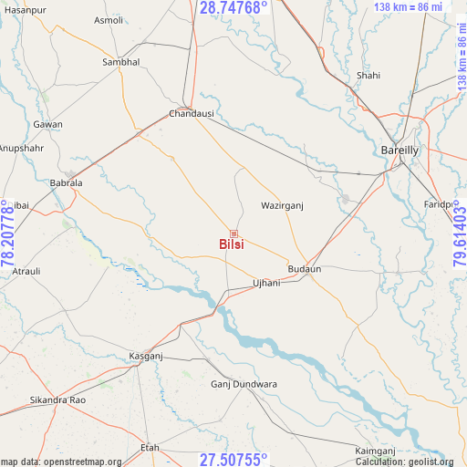
| Upper-left | 28.74768°, | 78.20778° |
| Center: | 28.12941°, | 78.9109° |
| Lower-right: | 27.50755°, | 79.61403° |
| Map W x H: | 137.9×137.9 km | = 85.7×85.7mi |
| max Lat: | 34.9274° ⇑14.9% North |
| Bilsi: | 28.12941° |
| min Lat: | ⇓85.1% South 8.09008° |
| min Long | Bilsi | max Long |
| 68.82655° | 78.9109° | 96.81° |
| W 58.2%⇐ | ⇒41.8% E |
Elevation
Elevation of Bilsi is 178 m = 584 ft, and this is 117.6 m = 386 ft below average elevation for this country.
| Max E: |
3681 m = 12077 ft | 54.4% |
| Avg. | 295.6 m = 970 ft | |
| Bilsi | 178 m = 584 ft | |
Min E: |
1 m = 3 ft | 45.6% |
See also: India elevation on elevation.city.
Geographical zone
Bilsi is located in North temperate zone (between Tropic of Cancer and the Arctic Circle). Distance of this Northern Tropic circle is 521.8 km =324.2 mi to South.| Distance of | km | miles | from Bilsi |
|---|---|---|---|
| North Pole | 6879.4 | 4274.7 | to North |
| Arctic Circle | 4273.5 | 2655.4 | to North |
| Tropic Cancer | 521.8 | 324.2 | to South |
| Equator | 3127.7 | 1943.5 | to South |


Nearby cities:
15 places around Bilsi: (largest is in red/bold)
• Aonla
29.7 km =18.5 mi,  57°
57°
• Bahjoi
40.6 km =25.2 mi,  316°
316°
• Bisauli
20 km =12.4 mi,  7°
7°
• Budaun
23.5 km =14.6 mi,  115°
115°
• Chanduasi
38 km =23.6 mi,  340°
340°
• Islāmnagar
28.7 km =17.8 mi, 320°
• Kakrāla
38.3 km =23.8 mi,  133°
133°
• Kāsganj
44.1 km =27.4 mi,  216°
216°
• Narauli
44 km =27.3 mi,  334°
334°
• Sahaswān
16.9 km =10.5 mi,  247°
247°
• Sahāwar
37.8 km =23.5 mi,  191°
191°
• Sarauli
44.2 km =27.5 mi,  23°
23°
• Soron
31.1 km =19.3 mi,  211°
211°
• Ujhāni
17 km =10.6 mi,  145°
145°
• Wazīrganj
17 km =10.6 mi, 57°
Sources, notices
• [Note1] Compared only with cities in India existing in our database
• [Src1] Map data: © OpenStreetMap contributors (CC-BY-SA)
• [Src2] Other city data from geonames.org with taken over terms of usage.
• [Src3] Geographical zone / Annual Mean Temperature by Robert A. Rohde @ Wikipedia
