Wazīrganj geodata
Wazīrganj (Uttar Pradesh) is a populated place; located in India in Asia/Kolkata (GMT+5.5) time zone. With population of 19,372 people, there are 2091 cities with bigger population in this country. Compared to other cities in India, 85.5% of cities are located further ↓South; 59.4% of cities are located further ←West and 54.4% of cities have higher elevation than Wazīrganj. Note1


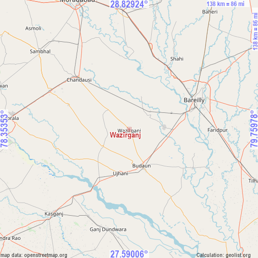
Wazīrganj GPS coordinates[2]
28° 12' 41.22" North, 79° 3' 23.94" East
| Map corner | latitude | longitude |
|---|---|---|
| Upper-left | 28.82924°, | 78.35353° |
| Center: | 28.21145°, | 79.05665° |
| Lower-right: | 27.59006°, | 79.75978° |
| Map W x H: | 137.8×137.8 km | = 85.6×85.6mi |
| max Lat: | 34.9274° ⇑14.5% North |
| Wazīrganj: | 28.21145° |
| min Lat: | ⇓85.5% South 8.09008° |
| min Long | Wazīrganj | max Long |
| 68.82655° | 79.05665° | 96.81° |
| W 59.4%⇐ | ⇒40.6% E |
Elevation
Elevation of Wazīrganj is 178 m = 584 ft, and this is 117.6 m = 386 ft below average elevation for this country.
| Max E: |
3681 m = 12077 ft | 54.4% |
| Avg. | 295.6 m = 970 ft | |
| Wazīrganj | 178 m = 584 ft | |
Min E: |
1 m = 3 ft | 45.6% |
See also: India elevation on elevation.city.
Geographical zone
Wazīrganj is located in North temperate zone (between Tropic of Cancer and the Arctic Circle). Distance of this Northern Tropic circle is 530.9 km =329.9 mi to South.| Distance of | km | miles | from Wazīrganj |
|---|---|---|---|
| North Pole | 6870.2 | 4268.9 | to North |
| Arctic Circle | 4264.4 | 2649.8 | to North |
| Tropic Cancer | 530.9 | 329.9 | to South |
| Equator | 3136.8 | 1949.1 | to South |


Nearby cities:
15 places around Wazīrganj: (largest is in red/bold)
• Aonla
12.7 km =7.9 mi,  56°
56°
• Bareilly
40.6 km =25.2 mi, 64°
• Bilsi
17 km =10.6 mi,  237°
237°
• Bisauli
15.9 km =9.9 mi,  312°
312°
• Budaun
20.5 km =12.7 mi,  160°
160°
• Chanduasi
37.8 km =23.5 mi, 314°
• Dātāganj
40.2 km =25 mi,  120°
120°
• Fatehganj West
37.4 km =23.2 mi,  40°
40°
• Islāmnagar
35 km =21.7 mi,  291°
291°
• Kakrāla
37.9 km =23.5 mi, 159°
• Mīrganj
39.4 km =24.5 mi,  22°
22°
• Sahaswān
33.7 km =20.9 mi, 242°
• Sarauli
31.6 km =19.6 mi,  6°
6°
• Shāhābād
39.8 km =24.7 mi,  353°
353°
• Ujhāni
23.6 km =14.7 mi,  191°
191°
Sources, notices
• [Note1] Compared only with cities in India existing in our database
• [Src1] Map data: © OpenStreetMap contributors (CC-BY-SA)
• [Src2] Other city data from geonames.org with taken over terms of usage.
• [Src3] Geographical zone / Annual Mean Temperature by Robert A. Rohde @ Wikipedia
