Bahjoi geodata
Bahjoi (Uttar Pradesh) is a populated place; located in India in Asia/Kolkata (GMT+5.5) time zone. With population of 33,752 people, there are 1289 cities with bigger population in this country. Compared to other cities in India, 86.3% of cities are located further ↓South; 55.4% of cities are located further ←West and 51.7% of cities have higher elevation than Bahjoi. Note1


Bahjoi GPS coordinates[2]
28° 23' 42.072" North, 78° 37' 35.724" East
| Map corner | latitude | longitude |
|---|---|---|
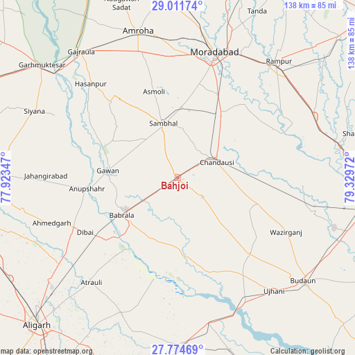
| Upper-left | 29.01174°, | 77.92347° |
| Center: | 28.39502°, | 78.62659° |
| Lower-right: | 27.77469°, | 79.32972° |
| Map W x H: | 137.5×137.5 km | = 85.4×85.4mi |
| max Lat: | 34.9274° ⇑13.7% North |
| Bahjoi: | 28.39502° |
| min Lat: | ⇓86.3% South 8.09008° |
| min Long | Bahjoi | max Long |
| 68.82655° | 78.62659° | 96.81° |
| W 55.4%⇐ | ⇒44.6% E |
Elevation
Elevation of Bahjoi is 193 m = 633 ft, and this is 102.6 m = 337 ft below average elevation for this country.
| Max E: |
3681 m = 12077 ft | 51.7% |
| Avg. | 295.6 m = 970 ft | |
| Bahjoi | 193 m = 633 ft | |
Min E: |
1 m = 3 ft | 48.3% |
See also: India elevation on elevation.city.
Geographical zone
Bahjoi is located in North temperate zone (between Tropic of Cancer and the Arctic Circle). Distance of this Northern Tropic circle is 551.3 km =342.6 mi to South.| Distance of | km | miles | from Bahjoi |
|---|---|---|---|
| North Pole | 6849.8 | 4256.3 | to North |
| Arctic Circle | 4243.9 | 2637 | to North |
| Tropic Cancer | 551.3 | 342.6 | to South |
| Equator | 3157.2 | 1961.8 | to South |


Nearby cities:
15 places around Bahjoi: (largest is in red/bold)
• Anūpshahr
35.2 km =21.9 mi,  263°
263°
• Babrāla
26.1 km =16.2 mi,  236°
236°
• Bilsi
40.6 km =25.2 mi,  136°
136°
• Bilāri
30.5 km =19 mi,  34°
34°
• Bisauli
31.9 km =19.8 mi,  107°
107°
• Chanduasi
16.5 km =10.3 mi,  67°
67°
• Gawān
27 km =16.8 mi,  275°
275°
• Gunnaur
25.1 km =15.6 mi,  226°
226°
• Islāmnagar
12.1 km =7.5 mi,  127°
127°
• Kundarkhi
35.6 km =22.1 mi, 25°
• Narauli
13.3 km =8.3 mi,  40°
40°
• Naraura
31.8 km =19.8 mi, 227°
• Sahaswān
37.9 km =23.5 mi,  161°
161°
• Sambhal
21.8 km =13.5 mi,  345°
345°
• Sirsi
27.2 km =16.9 mi,  3°
3°
Sources, notices
• [Note1] Compared only with cities in India existing in our database
• [Src1] Map data: © OpenStreetMap contributors (CC-BY-SA)
• [Src2] Other city data from geonames.org with taken over terms of usage.
• [Src3] Geographical zone / Annual Mean Temperature by Robert A. Rohde @ Wikipedia
