Tāki geodata
Tāki (West Bengal) is a populated place; located in India in Asia/Kolkata (GMT+5.5) time zone. With population of 40,113 people, there are 1098 cities with bigger population in this country. Compared to other cities in India, 52.3% of cities are located further ↑North; 95.1% of cities are located further ←West and 96.4% of cities have higher elevation than Tāki. Note1


Tāki GPS coordinates[2]
22° 35' 19.212" North, 88° 55' 57.108" East
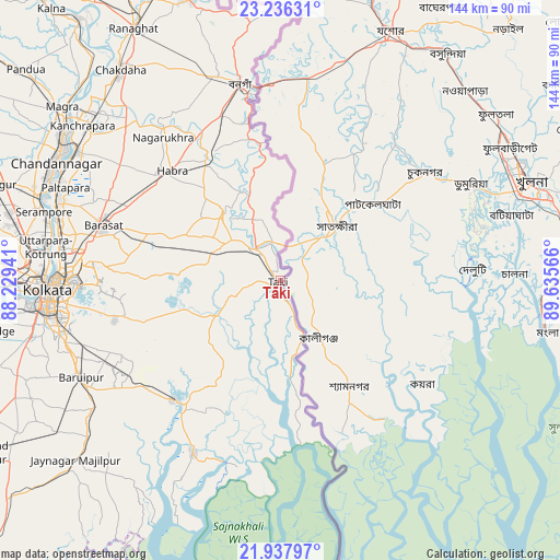
| Map corner | latitude | longitude |
|---|---|---|
| Upper-left | 23.23631°, | 88.22941° |
| Center: | 22.58867°, | 88.93253° |
| Lower-right: | 21.93797°, | 89.63566° |
| Map W x H: | 144.4×144.4 km | = 89.7×89.7mi |
| max Lat: | 34.9274° ⇑52.3% North |
| Tāki: | 22.58867° |
| min Lat: | ⇓47.7% South 8.09008° |
| min Long | Tāki | max Long |
| 68.82655° | 88.93253° | 96.81° |
| W 95.1%⇐ | ⇒4.9% E |
Elevation
Elevation of Tāki is 10 m = 33 ft, and this is 285.6 m = 937 ft below average elevation for this country.
| Max E: |
3681 m = 12077 ft | 96.4% |
| Avg. | 295.6 m = 970 ft | |
| Tāki | 10 m = 33 ft | |
Min E: |
1 m = 3 ft | 3.6% |
See also: Tāki elevation on elevation.city.
Geographical zone
Tāki is located in North Torrid zone (between Equator and Tropic of Cancer). Distance of this Northern Tropic circle is 94.3 km =58.6 mi to North.| Distance of | km | miles | from Tāki |
|---|---|---|---|
| North Pole | 7495.4 | 4657.4 | to North |
| Arctic Circle | 4889.5 | 3038.2 | to North |
| Tropic Cancer | 94.3 | 58.6 | to North |
| Equator | 2511.6 | 1560.6 | to South |


Nearby cities:
15 places around Tāki: (largest is in red/bold)
• Ashoknagar Kalyangarh
43.1 km =26.8 mi,  315°
315°
• Badūria
22.9 km =14.2 mi, 319°
• Bangaon
51.9 km =32.2 mi,  348°
348°
• Bārāsat
48.5 km =30.1 mi,  287°
287°
• Canning
41.2 km =25.6 mi,  222°
222°
• Chāmpāhāti
49.9 km =31 mi,  245°
245°
• Gobārdānga
36.9 km =22.9 mi,  330°
330°
• Gopālpur
18.9 km =11.7 mi,  280°
280°
• Gosāba
49 km =30.4 mi,  196°
196°
• Gurdaha
24.1 km =15 mi,  312°
312°
• Hābra
40 km =24.9 mi, 314°
• Madhyamgram
51.2 km =31.8 mi, 282°
• Nagarukhra
49.5 km =30.8 mi, 322°
• Raypur
47.7 km =29.6 mi, 245°
• Ula
41.4 km =25.7 mi, 291°
Sources, notices
• [Note1] Compared only with cities in India existing in our database
• [Src1] Map data: © OpenStreetMap contributors (CC-BY-SA)
• [Src2] Other city data from geonames.org with taken over terms of usage.
• [Src3] Geographical zone / Annual Mean Temperature by Robert A. Rohde @ Wikipedia
