Nāḩiyat ash Shināfīyah geodata
Nāḩiyat ash Shināfīyah (Al Qādisīyah) is a populated place; located in Iraq in Asia/Baghdad (GMT+3) time zone. With population of 22,643 people, there are 64 cities with bigger population in this country. Compared to other cities in Iraq, 85.9% of cities are located further ↑North; 59.2% of cities are located further ←West and 81% of cities have higher elevation than Nāḩiyat ash Shināfīyah. Note1
Current local time in Nāḩiyat ash Shināfīyah:
10:41 AM, WednesdayDifference from your time zone: hours


Nāḩiyat ash Shināfīyah GPS coordinates[2]
31° 35' 1.536" North, 44° 38' 48.3" East
| Map corner | latitude | longitude |
|---|---|---|
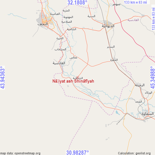
| Upper-left | 32.1808°, | 43.94363° |
| Center: | 31.58376°, | 44.64675° |
| Lower-right: | 30.98287°, | 45.34988° |
| Map W x H: | 133.2×133.2 km | = 82.8×82.8mi |
| max Lat: | 37.22781° ⇑85.9% North |
| Nāḩiyat ash Shināfīyah: | 31.58376° |
| min Lat: | ⇓14.1% South 29.97421° |
| min Long | Nāḩiyat ash | max Long |
| 40.28586° | 44.64675° | 48.47309° |
| W 59.2%⇐ | ⇒40.8% E |
Elevation
Elevation of Nāḩiyat ash Shināfīyah is 21 m = 69 ft, and this is 272 m = 892 ft below average elevation for this country.
| Max E: |
1316 m = 4318 ft | 81% |
| Avg. | 293 m = 961 ft | |
| Nāḩiyat ash Shināfīyah | 21 m = 69 ft | |
Min E: |
1 m = 3 ft | 19% |
See also: Iraq elevation on elevation.city.
Geographical zone
Nāḩiyat ash Shināfīyah is located in North temperate zone (between Tropic of Cancer and the Arctic Circle). Distance of this Northern Tropic circle is 905.9 km =562.9 mi to South.| Distance of | km | miles | from Nāḩiyat ash Shināfīyah |
|---|---|---|---|
| North Pole | 6495.3 | 4036 | to North |
| Arctic Circle | 3889.4 | 2416.8 | to North |
| Tropic Cancer | 905.9 | 562.9 | to South |
| Equator | 3511.8 | 2182.1 | to South |


Nearby cities:
15 places around Nāḩiyat ash Shināfīyah: (largest is in red/bold)
• Ad Dīwānīyah
52.6 km =32.7 mi,  30°
30°
• Al Hindīyah
114.1 km =70.9 mi,  339°
339°
• Al Hāshimīyah
86.7 km =53.9 mi,  0°
0°
• Al Manādhirah
39 km =24.2 mi, 337°
• Al Mishkhāb
28.7 km =17.8 mi,  328°
328°
• Al Ḩamzah
34.9 km =21.7 mi,  63°
63°
• Al Ḩillah
100.2 km =62.3 mi,  347°
347°
• Ar Rumaythah
53.1 km =33 mi,  96°
96°
• As Samawah
67.5 km =41.9 mi,  114°
114°
• Ash Shāmīyah
42.3 km =26.3 mi, 354°
• Imam Qasim
79.5 km =49.4 mi, 2°
• Kufa
55.5 km =34.5 mi, 339°
• Nahiyat Ghammas
17.9 km =11.1 mi, 351°
• Najaf
56.8 km =35.3 mi, 329°
• ‘Afak
77.9 km =48.4 mi,  46°
46°
Sources, notices
• [Note1] Compared only with cities in Iraq existing in our database
• [Src1] Map data: © OpenStreetMap contributors (CC-BY-SA)
• [Src2] Other city data from geonames.org with taken over terms of usage.
• [Src3] Geographical zone / Annual Mean Temperature by Robert A. Rohde @ Wikipedia
