Al Hāshimīyah geodata
Al Hāshimīyah (Bābil) is a seat of a second-order administrative division; located in Iraq in Asia/Baghdad (GMT+3) time zone. In our database, there are 71 cities with bigger population. Compared to other cities in Iraq, 73.9% of cities are located further ↑North; 59.9% of cities are located further ←West and 73.9% of cities have higher elevation than Al Hāshimīyah. Note1


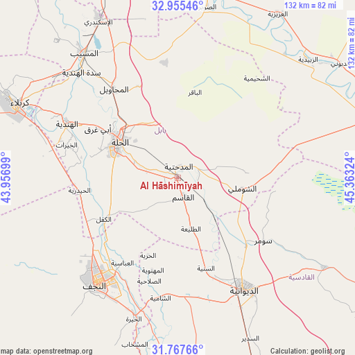
Al Hāshimīyah GPS coordinates[2]
32° 21' 48.636" North, 44° 39' 36.396" East
| Map corner | latitude | longitude |
|---|---|---|
| Upper-left | 32.95546°, | 43.95699° |
| Center: | 32.36351°, | 44.66011° |
| Lower-right: | 31.76766°, | 45.36324° |
| Map W x H: | 132.1×132.1 km | = 82.1×82.1mi |
| max Lat: | 37.22781° ⇑73.9% North |
| Al Hāshimīyah: | 32.36351° |
| min Lat: | ⇓26.1% South 29.97421° |
| min Long | Al Hāshimīyah | max Long |
| 40.28586° | 44.66011° | 48.47309° |
| W 59.9%⇐ | ⇒40.1% E |
Elevation
Elevation of Al Hāshimīyah is 28 m = 92 ft, and this is 265 m = 869 ft below average elevation for this country.
| Max E: |
1316 m = 4318 ft | 73.9% |
| Avg. | 293 m = 961 ft | |
| Al Hāshimīyah | 28 m = 92 ft | |
Min E: |
1 m = 3 ft | 26.1% |
See also: Iraq elevation on elevation.city.
Geographical zone
Al Hāshimīyah is located in North temperate zone (between Tropic of Cancer and the Arctic Circle). Distance of this Northern Tropic circle is 992.6 km =616.8 mi to South.| Distance of | km | miles | from Al Hāshimīyah |
|---|---|---|---|
| North Pole | 6408.6 | 3982.1 | to North |
| Arctic Circle | 3802.7 | 2362.9 | to North |
| Tropic Cancer | 992.6 | 616.8 | to South |
| Equator | 3598.5 | 2236 | to South |


Nearby cities:
15 places around Al Hāshimīyah: (largest is in red/bold)
• Ad Dīwānīyah
48.2 km =30 mi,  148°
148°
• Al Hindīyah
45.4 km =28.2 mi,  296°
296°
• Al Manādhirah
53.3 km =33.1 mi,  197°
197°
• Al Maḩāwīl
40.7 km =25.3 mi,  324°
324°
• Al Mishkhāb
64.2 km =39.9 mi,  194°
194°
• Al Musayyib
57.7 km =35.9 mi, 323°
• Al Ḩillah
25.2 km =15.7 mi, 296°
• Ash Shāmīyah
44.9 km =27.9 mi, 187°
• Aş Şuwayrah
63.4 km =39.4 mi,  9°
9°
• Imam Qasim
7.6 km =4.7 mi,  163°
163°
• Karbala
65.9 km =40.9 mi, 295°
• Kufa
40.4 km =25.1 mi,  210°
210°
• Najaf
47.8 km =29.7 mi,  218°
218°
• Nāḩīyat Saddat al Hindīyah
53 km =32.9 mi, 317°
• ‘Afak
64.5 km =40.1 mi,  121°
121°
Sources, notices
• [Note1] Compared only with cities in Iraq existing in our database
• [Src1] Map data: © OpenStreetMap contributors (CC-BY-SA)
• [Src2] Other city data from geonames.org with taken over terms of usage.
• [Src3] Geographical zone / Annual Mean Temperature by Robert A. Rohde @ Wikipedia
