Ad Dīwānīyah geodata
Ad Dīwānīyah (Al Qādisīyah) is a seat of a first-order administrative division; located in Iraq in Asia/Baghdad (GMT+3) time zone. With population of 318,801 people, there are 13 cities with bigger population in this country. Compared to other cities in Iraq, 78.9% of cities are located further ↑North; 64.1% of cities are located further ←West and 76.8% of cities have higher elevation than Ad Dīwānīyah. Note1


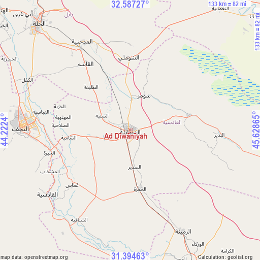
Ad Dīwānīyah GPS coordinates[2]
31° 59' 34.404" North, 44° 55' 31.872" East
| Map corner | latitude | longitude |
|---|---|---|
| Upper-left | 32.58727°, | 44.2224° |
| Center: | 31.99289°, | 44.92552° |
| Lower-right: | 31.39463°, | 45.62865° |
| Map W x H: | 132.6×132.6 km | = 82.4×82.4mi |
| max Lat: | 37.22781° ⇑78.9% North |
| Ad Dīwānīyah: | 31.99289° |
| min Lat: | ⇓21.1% South 29.97421° |
| min Long | Ad Dīwānīyah | max Long |
| 40.28586° | 44.92552° | 48.47309° |
| W 64.1%⇐ | ⇒35.9% E |
Elevation
Elevation of Ad Dīwānīyah is 25 m = 82 ft, and this is 268 m = 879 ft below average elevation for this country.
| Max E: |
1316 m = 4318 ft | 76.8% |
| Avg. | 293 m = 961 ft | |
| Ad Dīwānīyah | 25 m = 82 ft | |
Min E: |
1 m = 3 ft | 23.2% |
See also: Ad Dīwānīyah elevation on elevation.city.
Geographical zone
Ad Dīwānīyah is located in North temperate zone (between Tropic of Cancer and the Arctic Circle). Distance of this Northern Tropic circle is 951.4 km =591.2 mi to South.| Distance of | km | miles | from Ad Dīwānīyah |
|---|---|---|---|
| North Pole | 6449.8 | 4007.7 | to North |
| Arctic Circle | 3843.9 | 2388.5 | to North |
| Tropic Cancer | 951.4 | 591.2 | to South |
| Equator | 3557.3 | 2210.4 | to South |


Nearby cities:
15 places around Ad Dīwānīyah: (largest is in red/bold)
• Al Hāshimīyah
48.2 km =30 mi,  328°
328°
• Al Manādhirah
42.5 km =26.4 mi,  257°
257°
• Al Mishkhāb
46.2 km =28.7 mi,  243°
243°
• Al Ḩamzah
30.2 km =18.8 mi,  170°
170°
• Al Ḩillah
70.7 km =43.9 mi,  317°
317°
• An Nu‘mānīyah
77.6 km =48.2 mi,  36°
36°
• Ar Rumaythah
58 km =36 mi,  153°
153°
• As Samawah
81.4 km =50.6 mi, 154°
• Ash Shāmīyah
30.8 km =19.1 mi, 263°
• Imam Qasim
40.9 km =25.4 mi, 326°
• Kufa
46.2 km =28.7 mi,  278°
278°
• Nahiyat Ghammas
40.1 km =24.9 mi,  226°
226°
• Najaf
54.7 km =34 mi,  273°
273°
• Nāḩiyat ash Shināfīyah
52.6 km =32.7 mi,  210°
210°
• ‘Afak
31.4 km =19.5 mi,  75°
75°
Sources, notices
• [Note1] Compared only with cities in Iraq existing in our database
• [Src1] Map data: © OpenStreetMap contributors (CC-BY-SA)
• [Src2] Other city data from geonames.org with taken over terms of usage.
• [Src3] Geographical zone / Annual Mean Temperature by Robert A. Rohde @ Wikipedia
