Kufa geodata
Kufa (An Najaf) is a populated place; located in Iraq in Asia/Baghdad (GMT+3) time zone. With population of 110,000 people, there are 25 cities with bigger population in this country. Compared to other cities in Iraq, 77.5% of cities are located further ↑North; 52.1% of cities are located further →East and 78.2% of cities have higher elevation than Kufa. Note1


Kufa GPS coordinates[2]
32° 3' 4.104" North, 44° 26' 24.612" East
| Map corner | latitude | longitude |
|---|---|---|
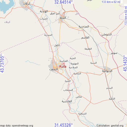
| Upper-left | 32.64514°, | 43.73705° |
| Center: | 32.05114°, | 44.44017° |
| Lower-right: | 31.45326°, | 45.1433° |
| Map W x H: | 132.5×132.5 km | = 82.3×82.3mi |
| max Lat: | 37.22781° ⇑77.5% North |
| Kufa: | 32.05114° |
| min Lat: | ⇓22.5% South 29.97421° |
| min Long | Kufa | max Long |
| 40.28586° | 44.44017° | 48.47309° |
| W 47.9%⇐ | ⇒52.1% E |
Elevation
Elevation of Kufa is 24 m = 79 ft, and this is 269 m = 883 ft below average elevation for this country.
| Max E: |
1316 m = 4318 ft | 78.2% |
| Avg. | 293 m = 961 ft | |
| Kufa | 24 m = 79 ft | |
Min E: |
1 m = 3 ft | 21.8% |
See also: Kufa elevation on elevation.city.
Geographical zone
Kufa is located in North temperate zone (between Tropic of Cancer and the Arctic Circle). Distance of this Northern Tropic circle is 957.8 km =595.1 mi to South.| Distance of | km | miles | from Kufa |
|---|---|---|---|
| North Pole | 6443.3 | 4003.7 | to North |
| Arctic Circle | 3837.4 | 2384.4 | to North |
| Tropic Cancer | 957.8 | 595.1 | to South |
| Equator | 3563.8 | 2214.4 | to South |


Nearby cities:
15 places around Kufa: (largest is in red/bold)
• Ad Dīwānīyah
46.2 km =28.7 mi,  98°
98°
• Al Hindīyah
58.6 km =36.4 mi,  340°
340°
• Al Hāshimīyah
40.4 km =25.1 mi,  30°
30°
• Al Manādhirah
16.6 km =10.3 mi,  164°
164°
• Al Maḩāwīl
67.9 km =42.2 mi,  357°
357°
• Al Mishkhāb
27.8 km =17.3 mi,  170°
170°
• Al Ḩamzah
62.4 km =38.8 mi,  125°
125°
• Al Ḩillah
45.9 km =28.5 mi, 357°
• Ash Shāmīyah
18.1 km =11.2 mi,  123°
123°
• Imam Qasim
35.7 km =22.2 mi,  39°
39°
• Karbala
73.9 km =45.9 mi,  328°
328°
• Nahiyat Ghammas
38.2 km =23.7 mi,  153°
153°
• Najaf
9.3 km =5.8 mi,  252°
252°
• Nāḩiyat ash Shināfīyah
55.5 km =34.5 mi, 159°
• Nāḩīyat Saddat al Hindīyah
75.4 km =46.9 mi,  348°
348°
Sources, notices
• [Note1] Compared only with cities in Iraq existing in our database
• [Src1] Map data: © OpenStreetMap contributors (CC-BY-SA)
• [Src2] Other city data from geonames.org with taken over terms of usage.
• [Src3] Geographical zone / Annual Mean Temperature by Robert A. Rohde @ Wikipedia
