Karbala geodata
Karbala (Karbalāʼ) is a seat of a first-order administrative division; located in Iraq in Asia/Baghdad (GMT+3) time zone. With population of 434,450 people, there are 10 cities with bigger population in this country. Compared to other cities in Iraq, 69% of cities are located further ↑North; 66.9% of cities are located further →East and 71.1% of cities have higher elevation than Karbala. Note1


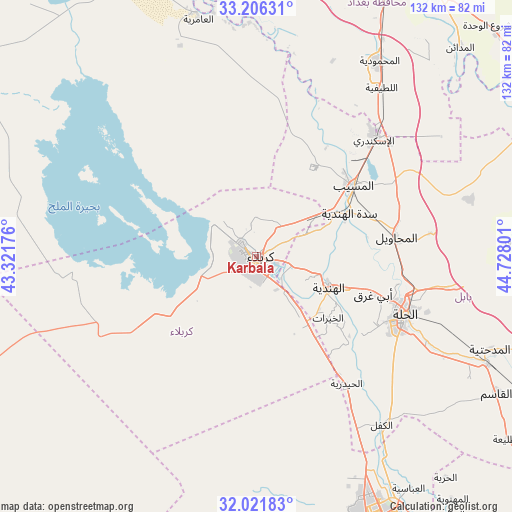
Karbala GPS coordinates[2]
32° 36' 57.708" North, 44° 1' 29.568" East
| Map corner | latitude | longitude |
|---|---|---|
| Upper-left | 33.20631°, | 43.32176° |
| Center: | 32.61603°, | 44.02488° |
| Lower-right: | 32.02183°, | 44.72801° |
| Map W x H: | 131.7×131.7 km | = 81.8×81.8mi |
| max Lat: | 37.22781° ⇑69% North |
| Karbala: | 32.61603° |
| min Lat: | ⇓31% South 29.97421° |
| min Long | Karbala | max Long |
| 40.28586° | 44.02488° | 48.47309° |
| W 33.1%⇐ | ⇒66.9% E |
Elevation
Elevation of Karbala is 32 m = 105 ft, and this is 261 m = 856 ft below average elevation for this country.
| Max E: |
1316 m = 4318 ft | 71.1% |
| Avg. | 293 m = 961 ft | |
| Karbala | 32 m = 105 ft | |
Min E: |
1 m = 3 ft | 28.9% |
See also: Karbala elevation on elevation.city.
Geographical zone
Karbala is located in North temperate zone (between Tropic of Cancer and the Arctic Circle). Distance of this Northern Tropic circle is 1020.6 km =634.2 mi to South.| Distance of | km | miles | from Karbala |
|---|---|---|---|
| North Pole | 6380.5 | 3964.7 | to North |
| Arctic Circle | 3774.6 | 2345.4 | to North |
| Tropic Cancer | 1020.6 | 634.2 | to South |
| Equator | 3626.6 | 2253.5 | to South |


Nearby cities:
15 places around Karbala: (largest is in red/bold)
• Abū Ghurayb
78.1 km =48.5 mi,  11°
11°
• Al Fallūjah
84.5 km =52.5 mi,  344°
344°
• Al Hindīyah
20.5 km =12.7 mi,  112°
112°
• Al Hāshimīyah
65.9 km =40.9 mi,  115°
115°
• Al Maḩmūdīyah
58.9 km =36.6 mi,  32°
32°
• Al Maḩāwīl
36.3 km =22.6 mi,  82°
82°
• Al Musayyib
30.7 km =19.1 mi,  53°
53°
• Al Ḩillah
40.7 km =25.3 mi, 114°
• Aş Şuwayrah
78.2 km =48.6 mi,  63°
63°
• Baghdad
87.9 km =54.6 mi,  23°
23°
• Imam Qasim
71.1 km =44.2 mi, 119°
• Kufa
73.9 km =45.9 mi,  148°
148°
• Najaf
72.2 km =44.9 mi,  155°
155°
• Nāḩīyat Saddat al Hindīyah
26.2 km =16.3 mi,  65°
65°
• ‘Ayn Tamr
50.6 km =31.4 mi,  263°
263°
In other languages:
- In Spanish: Kerbala
- In France: Kerbala
- In German: Kerbela
- In Italian: Kerbela, Kerbala
- In Russian: Кербела
- In Chinese: 卡爾巴拉
Sources, notices
• [Note1] Compared only with cities in Iraq existing in our database
• [Src1] Map data: © OpenStreetMap contributors (CC-BY-SA)
• [Src2] Other city data from geonames.org with taken over terms of usage.
• [Src3] Geographical zone / Annual Mean Temperature by Robert A. Rohde @ Wikipedia
