Siglufjörður geodata
Siglufjörður (Northeast) is a populated place; located in Iceland in Atlantic/Reykjavik (GMT+0) time zone. With population of 1,190 people, there are 25 cities with bigger population in this country. Compared to other cities in Iceland, 97.8% of cities are located further ↓South; 71.7% of cities are located further ←West and 60.9% of cities have higher elevation than Siglufjörður. Note1


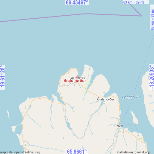
Siglufjörður GPS coordinates[2]
66° 9' 7.128" North, 18° 54' 29.34" West
| Map corner | latitude | longitude |
|---|---|---|
| Upper-left | 66.43467°, | -19.61128° |
| Center: | 66.15198°, | -18.90815° |
| Lower-right: | 65.8661°, | -18.20503° |
| Map W x H: | 63.2×63.2 km | = 39.3×39.3mi |
| max Lat: | 66.15917° ⇑2.2% North |
| Siglufjörður: | 66.15198° |
| min Lat: | ⇓97.8% South 63.44273° |
| min Long | Siglufjörður | max Long |
| -23.99596° | -18.90815° | -13.68368° |
| W 71.7%⇐ | ⇒28.3% E |
Elevation
Elevation of Siglufjörður is 13 m = 43 ft, and this is 8.3 m = 27 ft below average elevation for this country.
| Max E: |
105 m = 344 ft | 60.9% |
| Avg. | 21.3 m = 70 ft | |
| Siglufjörður | 13 m = 43 ft | |
Min E: |
1 m = 3 ft | 39.1% |
See also: Iceland elevation on elevation.city.
Geographical zone
Siglufjörður is located in North temperate zone (between Tropic of Cancer and the Arctic Circle). Distance of this North polar circle is 45.8 km =28.5 mi to North.| Distance of | km | miles | from Siglufjörður |
|---|---|---|---|
| North Pole | 2651.7 | 1647.7 | to North |
| Arctic Circle | 45.8 | 28.5 | to North |
| Tropic Cancer | 4749.5 | 2951.2 | to South |
| Equator | 7355.4 | 4570.4 | to South |


Nearby cities:
15 places around Siglufjörður: (largest is in red/bold)
• Akranes
251.3 km =156.2 mi,  215°
215°
• Akureyri
64 km =39.8 mi,  144°
144°
• Blönduós
83 km =51.6 mi,  228°
228°
• Borgarnes
227.4 km =141.3 mi, 217°
• Dalvík
26.5 km =16.5 mi, 139°
• Grundarhverfi
252.6 km =157 mi,  212°
212°
• Hvammstangi
125.2 km =77.8 mi, 227°
• Hveragerði
261.9 km =162.7 mi,  204°
204°
• Húsavík
71.8 km =44.6 mi,  99°
99°
• Laugar
84.4 km =52.4 mi,  124°
124°
• Mosfellsbær
256.3 km =159.3 mi, 210°
• Sauðárkrókur
56 km =34.8 mi, 216°
• Skagaströnd
72.9 km =45.3 mi,  239°
239°
• Stykkishólmur
212.3 km =131.9 mi, 235°
• Ólafsfjörður
15.2 km =9.4 mi,  128°
128°
Sources, notices
• [Note1] Compared only with cities in Iceland existing in our database
• [Src1] Map data: © OpenStreetMap contributors (CC-BY-SA)
• [Src2] Other city data from geonames.org with taken over terms of usage.
• [Src3] Geographical zone / Annual Mean Temperature by Robert A. Rohde @ Wikipedia
