Dalvík geodata
Dalvík (Northeast) is a populated place; located in Iceland in Atlantic/Reykjavik (GMT+0) time zone. With population of 1,359 people, there are 24 cities with bigger population in this country. Compared to other cities in Iceland, 89.1% of cities are located further ↓South; 76.1% of cities are located further ←West and 87% of cities have lower elevation than Dalvík. Note1


Dalvík GPS coordinates[2]
65° 58' 12.648" North, 18° 31' 42.996" West
| Map corner | latitude | longitude |
|---|---|---|
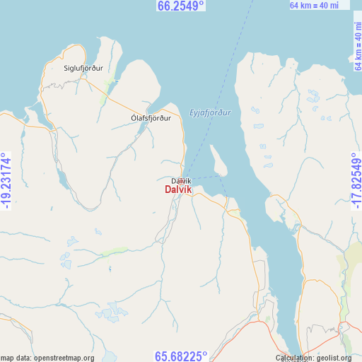
| Upper-left | 66.2549°, | -19.23174° |
| Center: | 65.97018°, | -18.52861° |
| Lower-right: | 65.68225°, | -17.82549° |
| Map W x H: | 63.7×63.7 km | = 39.6×39.6mi |
| max Lat: | 66.15917° ⇑10.9% North |
| Dalvík: | 65.97018° |
| min Lat: | ⇓89.1% South 63.44273° |
| min Long | Dalvík | max Long |
| -23.99596° | -18.52861° | -13.68368° |
| W 76.1%⇐ | ⇒23.9% E |
Elevation
Elevation of Dalvík is 40 m = 131 ft, and this is 18.7 m = 61 ft above average elevation for this country.
| Max E: |
105 m = 344 ft | 13% |
| Dalvík | 40 m 131 ft | |
| Avg. | 21.3 m = 70 ft | |
Min E: |
1 m = 3 ft | 87% |
See also: Iceland elevation on elevation.city.
Geographical zone
Dalvík is located in North temperate zone (between Tropic of Cancer and the Arctic Circle). Distance of this North polar circle is 66 km =41 mi to North.| Distance of | km | miles | from Dalvík |
|---|---|---|---|
| North Pole | 2671.9 | 1660.2 | to North |
| Arctic Circle | 66 | 41 | to North |
| Tropic Cancer | 4729.3 | 2938.6 | to South |
| Equator | 7335.2 | 4557.9 | to South |


Nearby cities:
15 places around Dalvík: (largest is in red/bold)
• Akranes
247 km =153.5 mi,  222°
222°
• Akureyri
37.7 km =23.4 mi,  147°
147°
• Blönduós
87 km =54.1 mi,  246°
246°
• Borgarnes
224.2 km =139.3 mi, 224°
• Grundarhverfi
246.8 km =153.4 mi, 218°
• Hvammstangi
127.6 km =79.3 mi,  240°
240°
• Höfn
245.9 km =152.8 mi,  140°
140°
• Húsavík
54.4 km =33.8 mi,  81°
81°
• Laugar
59.4 km =36.9 mi,  117°
117°
• Mosfellsbær
249.6 km =155.1 mi, 216°
• Sauðárkrókur
56.3 km =35 mi, 243°
• Siglufjörður
26.5 km =16.5 mi,  319°
319°
• Skagaströnd
82.2 km =51.1 mi,  258°
258°
• Vopnafjörður
169.9 km =105.6 mi,  98°
98°
• Ólafsfjörður
12 km =7.5 mi,  334°
334°
Sources, notices
• [Note1] Compared only with cities in Iceland existing in our database
• [Src1] Map data: © OpenStreetMap contributors (CC-BY-SA)
• [Src2] Other city data from geonames.org with taken over terms of usage.
• [Src3] Geographical zone / Annual Mean Temperature by Robert A. Rohde @ Wikipedia
